 Old Cumbria Gazetteer
 |
 |
|
| Leighton Hall, Lancashire | ||
| Leighton Hall | ||
| county:- | Lancashire | |
| locality type:- | buildings | |
| coordinates:- | SD494744 | |
| 1Km square:- | SD4974 | |
| 10Km square:- | SD47 | |
|
|
||
| evidence:- | old map:- Ogilby 1675 (plate 38) placename:- Lighton Hall |
|
| source data:- | Road strip map, hand coloured engraving, continuation of the
Road from London to Carlisle, scale about 1 inch to 1 mile, by
John Ogilby, London, 1675.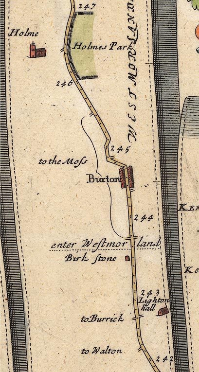 OG38m242.jpg In mile 242, Lancashire. "Lighton hall" House off the right of the road item:- JandMN : 21 Image © see bottom of page |
|
|
|
||
| evidence:- | descriptive text:- Fiennes 1698 |
|
| source data:- | Travel book, manuscript record of Journeys through England
including parts of the Lake District, by Celia Fiennes, 1698. "[Lancaster to Kendal] ... to one Lady Middleton; and by some Gentlemen which were travelling that way that was their acquantaince had the advantage of going through her parke ... it was very pleasant under the shade of the tall trees; it was an old timber house but the family being from home we had a free passage through on to the road againe ... this Lady Middleton was a papist and I believe the Gentlemen that was travelling were too;" |
|
|
|
||
| evidence:- | old map:- West 1784 map placename:- Leighton Hall |
|
| source data:- | Map, hand coloured engraving, A Map of the Lakes in Cumberland,
Westmorland and Lancashire, scale about 3.5 miles to 1 inch,
engraved by Paas, 53 Holborn, London, about 1784.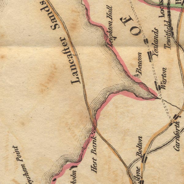 Ws02SD46.jpg item:- Armitt Library : A1221.1 Image © see bottom of page |
|
|
|
||
| evidence:- | old map:- Garnett 1850s-60s H placename:- Leighton Hall |
|
| source data:- | Map of the English Lakes, in Cumberland, Westmorland and
Lancashire, scale about 3.5 miles to 1 inch, published by John
Garnett, Windermere, Westmorland, 1850s-60s.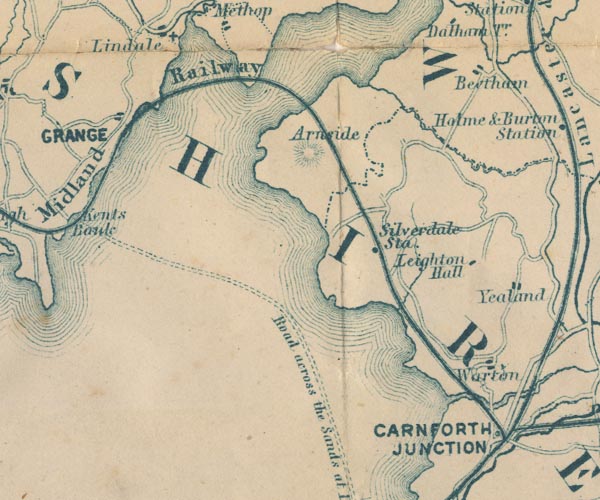 GAR2SD47.jpg "Leighton Hall" block, building item:- JandMN : 82.1 Image © see bottom of page |
|
|
|
||
 Lakes Guides menu.