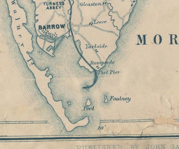
 Garnett 1850s-60s SD26


|

|
|
|
gazetteer links places may or may not be labelled on the map |
||

|
-- Barrow Docks |
|
|
|
-- Barrow Island |
|
|
|
-- Barrow-in-Furness -- "BARROW" |
|
|
|
-- Foulney Island -- "Foulney" |
|
|
|
-- Furness Railway -- "Furness Railway" --
"Furness Railway" |
|
|
|
-- Leece -- "Leece" |
|
|
|
-- Piel Channel |
|
|
|
-- Piel Island -- "Peel" |
|
|
|
-- Piel Pier -- "Piel Pier" |
|
|
|
-- Rampside -- "Rampside" |
|
|
|
-- Roa Island |
|
|
|
-- Walney Channel |
|
|
|
-- Yarlside -- "Yarlside" |
|
|
civil parishes The area roughly includes parts of parishes:- Aldingham Barrow-in-Furness |
||
|
|
||
|
|
Lakes Guides menu. | |