 Old Cumbria Gazetteer
 |
 |
|
| Foulney Island, Barrow-in-Furness | ||
| Foulney Island | ||
| locality:- | Morecambe Bay | |
| civil parish:- | Barrow-in-Furness (formerly Lancashire) | |
| county:- | Cumbria | |
| locality type:- | island | |
| coordinates:- | SD24656401 (etc) | |
| 1Km square:- | SD2464 | |
| 10Km square:- | SD26 | |
|
|
||
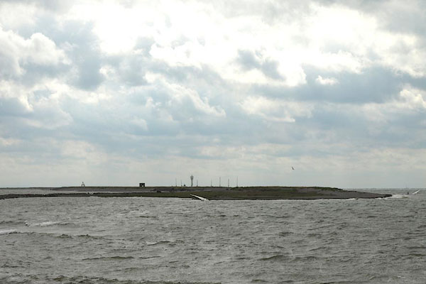 BPP48.jpg It's flat. (taken 16.8.2008) |
||
|
|
||
| evidence:- | old map:- OS County Series (Lan 28 5) placename:- Foulney Island |
|
| source data:- | Maps, County Series maps of Great Britain, scales 6 and 25
inches to 1 mile, published by the Ordnance Survey, Southampton,
Hampshire, from about 1863 to 1948. OS County Series (Lan 28 9) |
|
|
|
||
| evidence:- | old map:- Mercator 1595 (edn?) placename:- Foulney Iland |
|
| source data:- | Map, hand coloured engraving, Westmorlandia, Lancastria, Cestria
etc, ie Westmorland, Lancashire, Cheshire etc, scale about 10.5
miles to 1 inch, by Gerard Mercator, Duisberg, Germany, 1595,
edition 1613-16.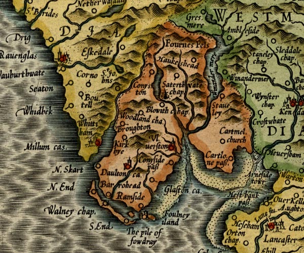 MER5LanA.jpg "Foulney iland" island item:- Armitt Library : 2008.14.3 Image © see bottom of page |
|
|
|
||
| evidence:- | poem:- Drayton 1612/1622 text placename:- Fulney |
|
| source data:- | Poem, Poly Olbion, by Michael Drayton, published by published by
John Marriott, John Grismand and Thomas Dewe, and others?
London, part 1 1612, part 2 1622. goto source goto sourcepage 136:- "... Against his [Neptune's] boystrous shocks, which this defensive Isle Of Walney still assayle, that shee doth scorne the while, Which to assist her hath the Pyle of Fouldra set, And Fulney at her backe, a pretty Insuley, Which all their forces bend, their Furnesse safe to keep: ..." |
|
|
|
||
| evidence:- | old map:- Morden 1695 (EW) placename:- Foulney |
|
| source data:- | Map, hand coloured engraving, England, including Wales, scale
about 27 miles to 1 inch, by Robert Morden, published by Abel
Swale Awnsham and John Churchil, London, about 1695. click to enlarge click to enlargeMRD3Cm.jpg "Foulney" island item:- JandMN : 339 Image © see bottom of page |
|
|
|
||
| evidence:- | old text:- Mackenzie 1776 placename:- Fowla Island |
|
| source data:- | Charts, and sailing directions, Nautical Descriptions of the
West Coast of Great Britain, Bristol Channel to Cape Wrath, by
Murdoch Mackenzie, published London, 1776. goto source Page 18:- "... ..." "To sail into Piel-of-Foudray from the N.; take half-flood, and keep Black-comb Hill out by Walney (to avoid Helpsford Sand) till you take out a small ruinous house on Fowla Island by Haw's-end; ..." |
|
|
|
||
| evidence:- | old map:- Garnett 1850s-60s H placename:- Foulney |
|
| source data:- | Map of the English Lakes, in Cumberland, Westmorland and
Lancashire, scale about 3.5 miles to 1 inch, published by John
Garnett, Windermere, Westmorland, 1850s-60s.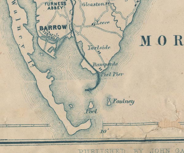 GAR2SD26.jpg "Foulney" island item:- JandMN : 82.1 Image © see bottom of page |
|
|
|
||
Lakes Guides menu.