 Garnett 1850s-60s SD19


|

|
|
|
gazetteer links places may or may not be labelled on the map |
||

|
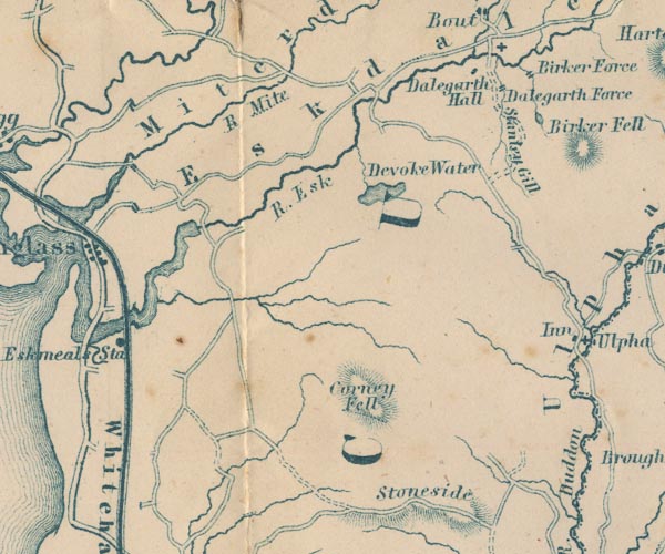
-- Birker Force -- "Birker Force" |
|
|
|
-- Corney Fell -- "Corney Fell" |
|
|
|
-- Dalegarth Hall -- "Dalegarth Hall" |
|
|
|
-- Devoke Water -- "Devoke Water" |
|
|
|
-- Esk, River -- "R. Esk" |
|
|
|
-- Eskdale -- "Eskdale" |
|
|
|
-- Eskmeals Station -- "Eskmeals Sta" |
|
|
|
-- Low Birker Tarn |
|
|
|
-- Mite, River -- "R. Mite" |
|
|
|
-- Miterdale -- "Miterdale" |
|
|
|
-- Stanley Force -- "Dalegarth Force" |
|
|
|
-- Stanley Gill -- "Stanley Gill" |
|
|
|
-- Whitehaven and Furness Junction Railway -- "Whitehaven &
Furness Junction Raily." |
|
|
civil parishes The area roughly includes parts of parishes:- Millom Without Bootle Ulpha Dunnerdale-with-Seathwaite Eskdale Irton with Santon Waberthwaite Muncaster |
||
|
|
||
|
|
Lakes Guides menu. | |