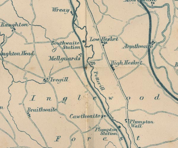
 Garnett 1850s-60s NY44


|

|
|
|
gazetteer links places may or may not be labelled on the map |
||

|
-- Braithwaite Hall -- "Braithwaite" |
|
|
|
-- Calthwaite -- "Cawthwaite" |
|
|
|
-- High Hesket -- "High Hesket" |
|
|
|
-- Inglewood Forest -- "Inglewood Forest" |
|
|
|
-- Ivegill -- "Ivegill" |
|
|
|
-- lake, Monkcastle |
|
|
|
-- Lancaster and Carlisle Railway -- "Lancaster & Carlisle
Railway" -- "Lancaster & Carlisle Railway" |
|
|
|
-- Low Hesket -- "Low Hesket" |
|
|
|
-- Mellguards -- "Mellguards" |
|
|
|
-- Petteril, River -- "R Petterill" -- "R.
Petterill" |
|
|
|
-- Plumpton Station -- "Plumpton Station" |
|
|
|
-- Plumpton Wall -- "Plumpton Wall" |
|
|
|
-- Penrith to Carlisle |
|
|
|
-- Southwaite Station -- "Southwaite Station" |
|
|
civil parishes The area roughly includes parts of parishes:- Lazonby Hesket Cumwhitton Dalston Castle Sowerby St Cuthbert Without Wetheral Skelton |
||
|
|
||
|
|
Lakes Guides menu. | |