Old Cumbria Gazetteer
 |
 |
|
||
| High Hesket, Hesket | ||||
| High Hesket | ||||
| Up Hesket | ||||
| civil parish:- | Hesket (formerly Cumberland) | |||
| county:- | Cumbria | |||
| locality type:- | locality | |||
| locality type:- | buildings | |||
| coordinates:- | NY47584442 | |||
| 1Km square:- | NY4744 | |||
| 10Km square:- | NY44 | |||
|
|
||||
| evidence:- | old map:- OS County Series (Cmd 31 15) placename:- High Hesket placename:- Hesket, High |
|||
| source data:- | Maps, County Series maps of Great Britain, scales 6 and 25
inches to 1 mile, published by the Ordnance Survey, Southampton,
Hampshire, from about 1863 to 1948. |
|||
|
|
||||
| evidence:- | perhaps old map:- Saxton 1579 placename:- Hesket |
|||
| source data:- | Map, hand coloured engraving, Westmorlandiae et Cumberlandiae Comitatus ie Westmorland
and Cumberland, scale about 5 miles to 1 inch, by Christopher Saxton, London, engraved
by Augustinus Ryther, 1576, published 1579-1645.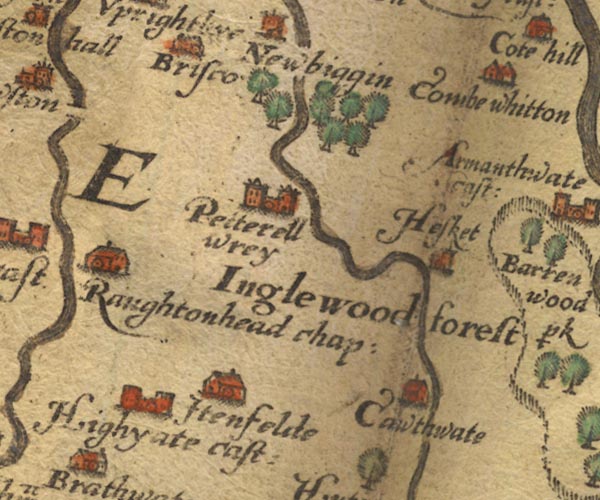 Sax9NY44.jpg Church, symbol for a parish or village, with a parish church. "Hesket" item:- private collection : 2 Image © see bottom of page |
|||
|
|
||||
| evidence:- | probably old map:- Mercator 1595 (edn?) placename:- Hesket |
|||
| source data:- | Map, hand coloured engraving, Northumbria, Cumberlandia, et
Dunelmensis Episcopatus, ie Northumberland, Cumberland and
Durham etc, scale about 6.5 miles to 1 inch, by Gerard Mercator,
Duisberg, Germany, about 1595. MER8CumD.jpg "Hesket" circle item:- JandMN : 169 Image © see bottom of page |
|||
|
|
||||
| evidence:- | probably old map:- Keer 1605 placename:- Hesket |
|||
| source data:- | Map, hand coloured engraving, Westmorland and Cumberland, scale
about 16 miles to 1 inch, probably by Pieter van den Keere, or
Peter Keer, about 1605 edition perhaps 1676. click to enlarge click to enlargeKER8.jpg "Hesket" dot, circle and tower; village item:- Dove Cottage : 2007.38.110 Image © see bottom of page |
|||
|
|
||||
| evidence:- | old map:- Speed 1611 (Cmd) placename:- Hesket |
|||
| source data:- | Map, hand coloured engraving, Cumberland and the Ancient Citie
Carlile Described, scale about 4 miles to 1 inch, by John Speed,
1610, published by J Sudbury and George Humble, Popes Head
Alley, London, 1611-12.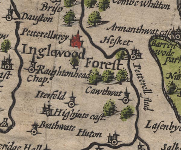 SP11NY44.jpg "Hesket" circle, building, tower item:- private collection : 16 Image © see bottom of page |
|||
|
|
||||
| evidence:- | old map:- Jansson 1646 placename:- Hesket |
|||
| source data:- | Map, hand coloured engraving, Cumbria and Westmoria, ie
Cumberland and Westmorland, scale about 3.5 miles to 1 inch, by
John Jansson, Amsterdam, Netherlands, 1646.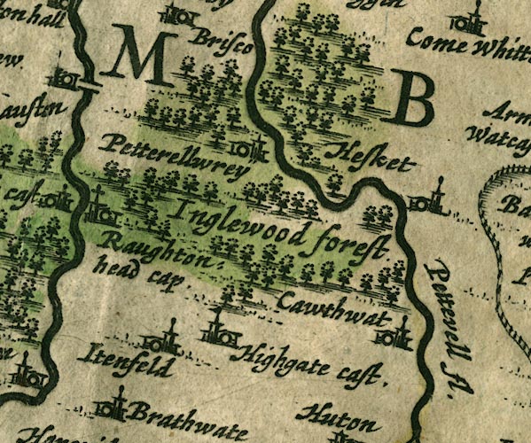 JAN3NY44.jpg "Hesket" Buildings and tower. item:- JandMN : 88 Image © see bottom of page |
|||
|
|
||||
| evidence:- | old map:- Ogilby 1675 (plate 38) placename:- Hesket |
|||
| source data:- | Road strip map, hand coloured engraving, continuation of the
Road from London to Carlisle, scale about 1 inch to 1 mile, by
John Ogilby, London, 1675.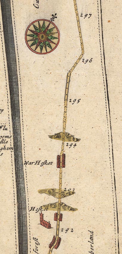 OG38m292.jpg In mile 292, Cumberland. "Hesket" houses each side of the road, and a church on the left. item:- JandMN : 21 Image © see bottom of page |
|||
|
|
||||
| evidence:- | old map:- Berry 1679 placename:- Hesket |
|||
| source data:- | Road map, diagram, The Grand Roads of England, engraved by John
Rich, made and published by William Berry, at the Sign of the
Globe, London, 1679. "Hesket" |
|||
|
|
||||
| evidence:- | possibly old map:- Seller 1694 (Cmd) placename:- Hesket |
|||
| source data:- | Map, uncoloured engraving, Cumberland, scale about 12 miles to 1
inch, by John Seller, 1694. click to enlarge click to enlargeSEL9.jpg "Hesket" circle, italic lowercase text; settlement or house item:- Dove Cottage : 2007.38.89 Image © see bottom of page |
|||
|
|
||||
| evidence:- | old map:- Morden 1695 (Cmd) placename:- Hesket |
|||
| source data:- | Map, uncoloured engraving, Cumberland, scale about 4 miles to 1
inch, by Robert Morden, 1695, published by Abel Swale, the
Unicorn, St Paul's Churchyard, Awnsham, and John Churchill, the
Black Swan, Paternoster Row, London, 1695-1715.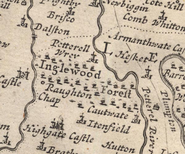 MD12NY44.jpg "Hesket" Circle, building and tower. item:- JandMN : 90 Image © see bottom of page |
|||
|
|
||||
| evidence:- | old map:- Ogilby 1699 map (edn 1712) placename:- Hesket |
|||
| source data:- | Road map, uncoloured engraving, a New Mapp of the Roads of England, by John Ogilby,
published by William Bray, Exeter Court, Strand, London, 1712. "Hesket" 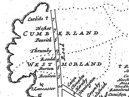 click to enlarge click to enlargeOGY7Cm.jpg item:- private collection : 263.1 Image © see bottom of page |
|||
|
|
||||
| evidence:- | old map:- Bowen 1720 (plate 94) placename:- Hesket |
|||
| source data:- | Strip maps, uncoloured engravings, road maps, The Road from
London to Carlisle, scale about 2 miles to 1 inch, with sections
in Lancashire and Westmorland, published by Emanuel Bowen, St
Katherines, London, 1720.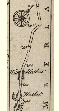 B094m292.jpg item:- Dove Cottage : 2007.38.100 Image © see bottom of page |
|||
|
|
||||
| evidence:- | old map:- Millward and Dickinson 1737 placename:- Hesket |
|||
| source data:- | Road map, photocopy, diagram, A New and Correct Map of Roads of
England, probably published by T Millward and B Dickinson, Inigo
Jones's Head, Fleet Street, London, 1737. "Hesket" 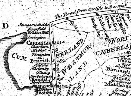 click to enlarge click to enlargeMWD1Cm.jpg item:- private collection : 264 Image © see bottom of page |
|||
|
|
||||
| evidence:- | old map:- Badeslade 1742 placename:- Hesket |
|||
| source data:- | Map, uncoloured engraving, A Map of Cumberland North from
London, scale about 11 miles to 1 inch, with descriptive text,
by Thomas Badeslade, London, engraved and published by William
Henry Toms, Union Court, Holborn, London, 1742. click to enlarge click to enlargeBD10.jpg "Hesket" circle, italic lowercase text; village, hamlet or locality item:- JandMN : 115 Image © see bottom of page |
|||
|
|
||||
| evidence:- | old map:- Bowen and Kitchin 1760 placename:- Hesketh |
|||
| source data:- | Map, hand coloured engraving, A New Map of the Counties of
Cumberland and Westmoreland Divided into their Respective Wards,
scale about 4 miles to 1 inch, by Emanuel Bowen and Thomas
Kitchin et al, published by T Bowles, Robert Sayer, and John
Bowles, London, 1760.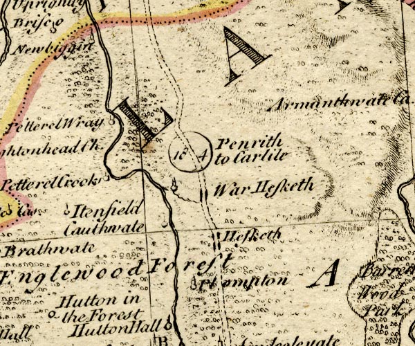 BO18NY44.jpg "Hesketh" blocks, on road item:- Armitt Library : 2008.14.10 Image © see bottom of page |
|||
|
|
||||
| evidence:- | old map:- Donald 1774 (Cmd) placename:- High Hesket placename:- Hesket, High |
|||
| source data:- | Map, hand coloured engraving, 3x2 sheets, The County of Cumberland, scale about 1
inch to 1 mile, by Thomas Donald, engraved and published by Joseph Hodskinson, 29
Arundel Street, Strand, London, 1774.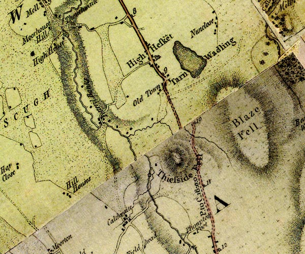 D4NY44SE.jpg "High Hesket" blocks, and usually a church, labelled in upright lowercase; a village item:- Carlisle Library : Map 2 Image © Carlisle Library |
|||
|
|
||||
| evidence:- | road book:- Cary 1798 (2nd edn 1802) placename:- High Hesket |
|||
| source data:- | Road book, itineraries, Cary's New Itinerary, by John Cary, 181
Strand, London, 2nd edn 1802. goto source goto source click to enlarge click to enlargeC38267.jpg page 267-268 "High Hesket" goto source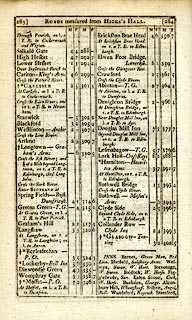 click to enlarge click to enlargeC38283.jpg page 283-284 "High Hesket" item:- JandMN : 228.1 Image © see bottom of page |
|||
|
|
||||
| evidence:- | old map:- Cooke 1802 placename:- High Hesket |
|||
| source data:- | Map, Cumberland, scale about 15.5 miles to 1 inch, by George
Cooke, 1802, bound in Gray's New Book of Roads, 1824, published
by Sherwood, Jones and Co, Paternoster Road, London, 1824. click to enlarge click to enlargeGRA1Cd.jpg "High Hesket" blocks, italic lowercase text, village, hamlet, locality item:- Hampshire Museums : FA2000.62.2 Image © see bottom of page |
|||
|
|
||||
| evidence:- | old map:- Cooke 1802 placename:- High Hesket |
|||
| source data:- | Map, The Lakes, Westmorland and Cumberland, scale about 8.5
miles to 1 inch, engravedby Neele and Son, published by
Sherwood, Jones and Co, Paternoster Road, London, 1824. click to enlarge click to enlargeGRA1Lk.jpg "High Hesket" blocks, italic lowercase text, village, hamlet, locality item:- Hampshire Museums : FA2000.62.5 Image © see bottom of page |
|||
|
|
||||
| evidence:- | old map:- Laurie and Whittle 1806 placename:- High Hesket |
|||
| source data:- | Road map, Completion of the Roads to the Lakes, scale about 10
miles to 1 inch, by Nathaniel Coltman? 1806, published by Robert
H Laurie, 53 Fleet Street, London, 1834. click to enlarge click to enlargeLw18.jpg "High Hesket 297" village or other place; distance from London item:- private collection : 18.18 Image © see bottom of page |
|||
|
|
||||
| evidence:- | old map:- Laurie and Whittle 1806 placename:- High Hesket |
|||
| source data:- | Road map, Continuation of the Roads to Glasgow and Edinburgh,
scale about 10 miles to 1 inch, by Nathaniel Coltman? 1806,
published by Robert H Laurie, 53 Fleet Street, London, 1834. click to enlarge click to enlargeLw21.jpg "High Hesket 297" village or other place; distance from London item:- private collection : 18.21 Image © see bottom of page |
|||
|
|
||||
| evidence:- | possibly old map:- Cooper 1808 placename:- Heskett |
|||
| source data:- | Map, uncoloured engraving, Cumberland, scale about 10.5 miles to
1 inch, drawn and engraved by Cooper, published by R Phillips,
Bridge Street, Blackfriars, London, 1808. click to enlarge click to enlargeCOP3.jpg "Heskett" circle; village or hamlet item:- JandMN : 86 Image © see bottom of page |
|||
|
|
||||
| evidence:- | old map:- Wallis 1810 (Cmd) placename:- High Hesket |
|||
| source data:- | Road map, hand coloured engraving, Cumberland, scale about 16
miles to 1 inch, by James Wallis, 77 Berwick Stree, Soho,
London, 1810. click to enlarge click to enlargeWL13.jpg "High Hesket" village, hamlet, house, ... item:- Dove Cottage : 2009.81.10 Image © see bottom of page |
|||
|
|
||||
| evidence:- | descriptive text:- Ford 1839 (3rd edn 1843) placename:- High Hesket |
|||
| source data:- | Guide book, A Description of Scenery in the Lake District, by
Rev William Ford, published by Charles Thurnam, Carlisle, by W
Edwards, 12 Ave Maria Lane, Charles Tilt, Fleet Street, William
Smith, 113 Fleet Street, London, by Currie and Bowman,
Newcastle, by Bancks and Co, Manchester, by Oliver and Boyd,
Edinburgh, and by Sinclair, Dumfries, 1839. goto source Page 174:- "..." "High Hesket, a large village, half-way between" goto sourcePage 175:- "Carlisle and Penrith. Has an excellent inn, the White Ox, conducted by Mrs. Pearson. ..." |
|||
|
|
||||
| evidence:- | old map:- Ford 1839 map placename:- High Hesket |
|||
| source data:- | Map, uncoloured engraving, Map of the Lake District of
Cumberland, Westmoreland and Lancashire, scale about 3.5 miles
to 1 inch, published by Charles Thurnam, Carlisle, and by R
Groombridge, 5 Paternoster Row, London, 3rd edn 1843.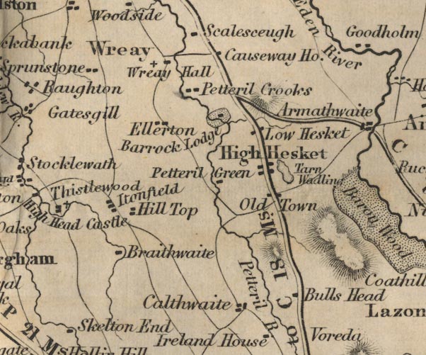 FD02NY44.jpg "High Hesket" item:- JandMN : 100.1 Image © see bottom of page |
|||
|
|
||||
| evidence:- | old map:- Garnett 1850s-60s H placename:- High Hesket |
|||
| source data:- | Map of the English Lakes, in Cumberland, Westmorland and
Lancashire, scale about 3.5 miles to 1 inch, published by John
Garnett, Windermere, Westmorland, 1850s-60s.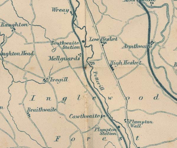 GAR2NY44.jpg "High Hesket" blocks, settlement item:- JandMN : 82.1 Image © see bottom of page |
|||
|
|
||||
| evidence:- | old print:- Bradley 1901 placename:- High Hesket |
|||
| source data:- | Print, uncoloured lithograph, Near High Hesket, Hesket, Cumberland, by Joseph Pennell,
published by Macmillan and Co, London, 1901.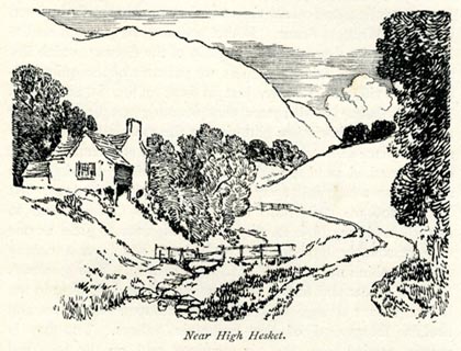 click to enlarge click to enlargeBRL170.jpg On page 263 of Highways and Byways in the Lake District, by A G Bradley. printed at bottom:- "Near High Hesket." item:- JandMN : 464.70 Image © see bottom of page |
|||
|
|
||||
| evidence:- | old text:- Harper 1907 item:- Gretna marriage; elopement |
|||
| source data:- | Guidebook, The Manchester and Glasgow Road, by Charles G Harper,
published by Chapman and Hall Ltd, London, 1907. HP01p179.txt Page 179:- "[At Gretna,] ELLIOT'S most romantic clients were the Earl of Westmoreland and Miss Child, who eloped in 1782. The father of the young lady was the famous London banker, whose great fortune, and the prospect of marrying it, dazzled the Earl quite as much as the beauty of his daughter and heiress. She fell in love with the noble suitor, whose proposal did not, however, commend itself to the banker. "Your blood, my lord, is good," said he, "but money is better;" and he refused his consent. But the disappointed suitor was not disheartened, and then lovers eloped in a four-horse chaise; his canny lordship having arranged beforehand for relays of horses all the way: prudently at the strategic point of Shap, hiring every horse to be found there. Mr, Child, enraged, lost no time in following. Using every effort that money could procure, he at last came up with the fugitives changing at High Hesket; and, leaping from his chaise, drew a pistol and shot one of the leaders of their conveyance. At the same moment, one of the Earl's servants ran behind Mr. Child's carriage and cut the leather braces suspending the body. The Earl and his love proceeded with three horses, with the father pursuing. Not for long, however, for presently the body fell over, and pursuit became a laggard and hopeless rearguard. One hundred guineas was the fee paid to the fortunate Elliot by the Earl. Mr. Child died within a year of the affair, it is supposed from disappointment and anger at his daughter's disobedience. Rowlandson has, in his caricature "Filial Affection," drawn a more or less close commentary upon this incident. The banker took excellent care that neither of them should have his money, which he devised to any issue of the marriage. Lady Westmoreland died in 1793, leaving six children, and the Earl married again, at which is instinctively revolted." "..." |
|||
|
|
||||
| evidence:- | old map:- Unknown 1910s placename:- High Hesket |
|||
| source data:- | Map, ms black and colour inks, Tarn Wadling and area, Hesket,
Cumberland, scale about 6 ins to 1 mile.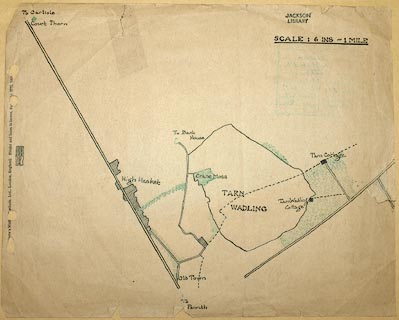 click to enlarge click to enlargeM043.jpg item:- Carlisle Library : Map 304 Image © Carlisle Library |
|||
|
|
||||
| evidence:- | old map:- Burrow 1920s |
|||
| source data:- | Road book, On the Road, Dunlop Pictorial Road Plans, volume V,
strip maps with parts in Westmorland, Cumberland etc, irregular
scale about 1.5 miles to 1 inch, by E J Burrow and Co,
Cheltenham, Gloucestershire, 1920s.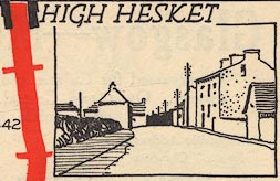 EJB3Vg25.jpg item:- private collection : 17 Image © see bottom of page |
|||
|
|
||||
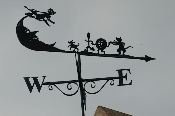
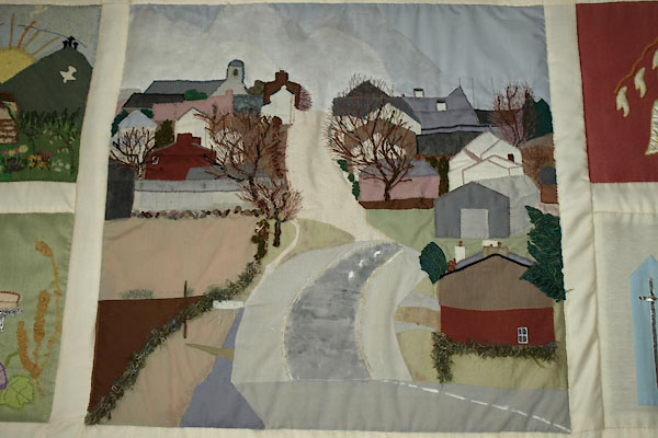 BWR97.jpg From a wall hanging in the church. (taken 8.6.2012) |
||||
|
|
||||
| places:- |
|
|||
|
||||
|
||||
|
||||
|
||||
|
||||
|
||||
|
||||
|
||||
|
||||
Lakes Guides menu.