 Garnett 1850s-60s NY41


|

|
|
|
gazetteer links places may or may not be labelled on the map |
||

|
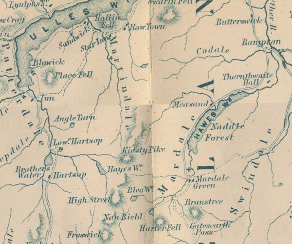
-- Angle Tarn -- "Angle Tarn" |
|
|
|
-- Blea Water -- "Blea Wr." |
|
|
|
-- Branstree -- "Branstree" |
|
|
|
-- Cawdale -- "Codale" |
|
|
|
-- Hartsop -- "Lowr. Hartsop" |
|
|
|
-- Hawes Water -- "HAWES WR." |
|
|
|
-- Hayeswater -- "Hayes Wr." |
|
|
|
-- High Street -- "High Street" |
|
|
|
-- Holy Trinity Church |
|
|
|
-- Howtown -- "How Town" |
|
|
|
-- Kidsty Pike -- "Kidsty Pike" |
|
|
|
-- Kirkstonefoot -- "Hartsop" |
|
|
|
-- lake, Fusedale |
|
|
|
-- Mardale -- "Mardale" |
|
|
|
-- Martindale -- "Martindale" |
|
|
|
-- Measand -- "Measand" |
|
|
|
-- Naddle Forest -- "Naddle Forest" |
|
|
|
-- Nan Bield Pass -- "Nan Bield" |
|
|
|
-- Place Fell -- "Place Fell" |
|
|
|
-- Sandwick -- "Sandwicks" |
|
|
|
-- Small Water |
|
|
civil parishes The area roughly includes parts of parishes:- Kentmere Shap Rural Longsleddale Patterdale Martindale Lakes Bampton Barton Matterdale |
||
|
|
||
|
|
Lakes Guides menu. | |