 Old Cumbria Gazetteer
 |
 |
|
| Angle Tarn, Martindale | ||
| runs into:- |  Angletarn Beck Angletarn Beck |
|
|
|
||
| Angle Tarn | ||
| civil parish:- | Martindale (formerly Westmorland) | |
| county:- | Cumbria | |
| locality type:- | tarn | |
| coordinates:- | NY41701435 (etc) | |
| 1Km square:- | NY4114 | |
| 10Km square:- | NY41 | |
| altitude:- | 1576 feet | |
| altitude:- | 480m | |
|
|
||
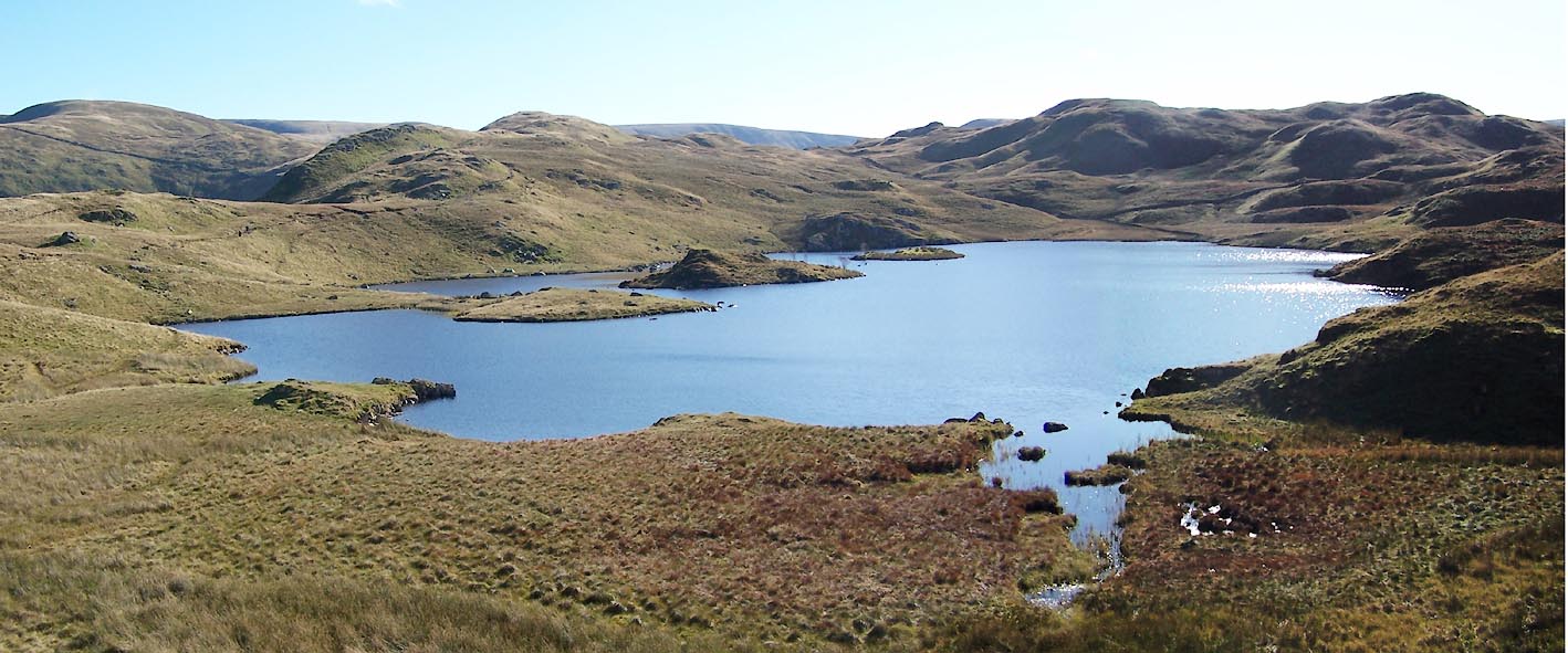
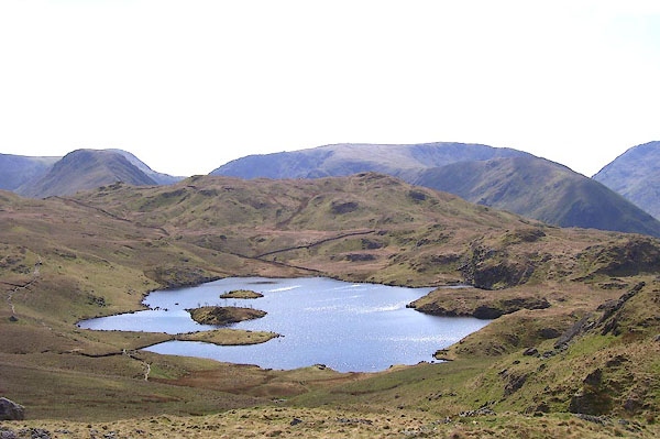 BNO73.jpg (taken 18.4.2007) 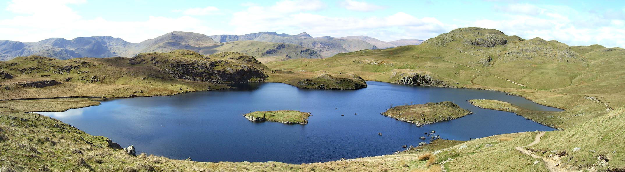 Click to enlarge BNO72.jpg (taken 18.4.2007) |
||
|
|
||
| evidence:- | old map:- OS County Series (Wmd 12 16) placename:- Angle Tarn |
|
| source data:- | Maps, County Series maps of Great Britain, scales 6 and 25
inches to 1 mile, published by the Ordnance Survey, Southampton,
Hampshire, from about 1863 to 1948. |
|
|
|
||
| evidence:- | old map:- Jefferys 1770 (Wmd) placename:- Angle Tarn |
|
| source data:- | Map, 4 sheets, The County of Westmoreland, scale 1 inch to 1
mile, surveyed 1768, and engraved and published by Thomas
Jefferys, London, 1770.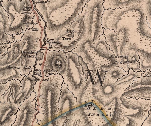 J5NY41SW.jpg "Angle Tarn" outline with form lines; lake or tarn item:- National Library of Scotland : EME.s.47 Image © National Library of Scotland |
|
|
|
||
| evidence:- | old map:- Cary 1789 (edn 1805) |
|
| source data:- | Map, uncoloured engraving, Westmoreland, scale about 2.5 miles
to 1 inch, by John Cary, London, 1789; edition 1805.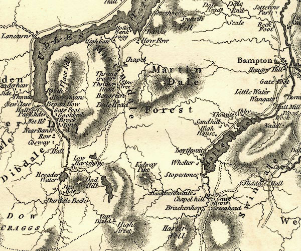 CY24NY41.jpg outline with shore form lines; lake or tarn item:- JandMN : 129 Image © see bottom of page |
|
|
|
||
| evidence:- | old map:- Laurie and Whittle 1806 placename:- Angle Tarn |
|
| source data:- | Road map, Completion of the Roads to the Lakes, scale about 10
miles to 1 inch, by Nathaniel Coltman? 1806, published by Robert
H Laurie, 53 Fleet Street, London, 1834. click to enlarge click to enlargeLw18.jpg "Angle Tarn" lake item:- private collection : 18.18 Image © see bottom of page |
|
|
|
||
| evidence:- | old map:- Otley 1818 |
|
| source data:- | Map, uncoloured engraving, The District of the Lakes,
Cumberland, Westmorland, and Lancashire, scale about 4 miles to
1 inch, by Jonathan Otley, 1818, engraved by J and G Menzies,
Edinburgh, Scotland, published by Jonathan Otley, Keswick,
Cumberland, et al, 1833.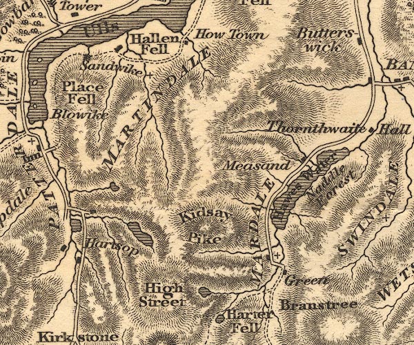 OT02NY41.jpg item:- JandMN : 48.1 Image © see bottom of page |
|
|
|
||
| evidence:- | descriptive text:- Otley 1823 (5th edn 1834) |
|
| source data:- | Guide book, A Concise Description of the English Lakes, the
mountains in their vicinity, and the roads by which they may be
visited, with remarks on the mineralogy and geology of the
district, by Jonathan Otley, published by the author, Keswick,
Cumberland now Cumbria, by J Richardson, London, and by Arthur
Foster, Kirkby Lonsdale, Cumbria, 1823; published 1823-49,
latterly as the Descriptive Guide to the English Lakes. goto source Page 34:- "... Angle Tarn, lying north of the last [Hayeswater], upon the mountain separating Patterdale from Martindale, is one of the smaller class; but of a curious shape, having two rocky islets and a small broken peninsula. Its stream in a quick descent, reaches the vale about half a mile further down. ..." goto sourcePage 35:- "... All these tarns afford good diversion for the angler; ... those [trout] of Angle tarn are by some considered of superior flavour; ..." |
|
|
|
||
| evidence:- | old map:- Ford 1839 map |
|
| source data:- | Map, uncoloured engraving, Map of the Lake District of
Cumberland, Westmoreland and Lancashire, scale about 3.5 miles
to 1 inch, published by Charles Thurnam, Carlisle, and by R
Groombridge, 5 Paternoster Row, London, 3rd edn 1843.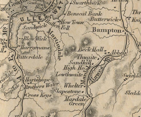 FD02NY41.jpg Outline. item:- JandMN : 100.1 Image © see bottom of page |
|
|
|
||
| evidence:- | old map:- Garnett 1850s-60s H placename:- Angle Tarn |
|
| source data:- | Map of the English Lakes, in Cumberland, Westmorland and
Lancashire, scale about 3.5 miles to 1 inch, published by John
Garnett, Windermere, Westmorland, 1850s-60s.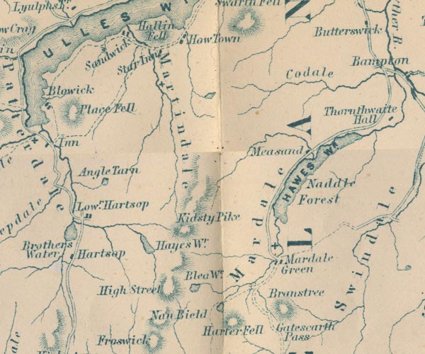 GAR2NY41.jpg "Angle Tarn" outline with shore form lines, lake or tarn item:- JandMN : 82.1 Image © see bottom of page |
|
|
|
||
| evidence:- | old print:- MacBride 1922 placename:- Angle Tarn item:- fell pony; pony |
|
| source data:- | Print, colour, Wild Mountain Ponies, Angle Tarn, Patterdale, by Alfred Heaton Cooper,
published by Adam and Charles Black, 4-6 Soho Square, London, 2nd edn 1928.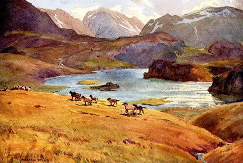 click to enlarge click to enlargeMB0122.jpg Tipped in opposite p.145 in Wild Lakeland by MacKenzie MacBride. printed at bottom:- "WILD MOUNTAIN PONIES, ANGLE TARN, PATTERDALE" signed at lower left:- "A. HEATON COOPER" item:- JandMN : 195.24 Image © see bottom of page |
|
|
|
||
 Click to enlarge BTS80.jpg (taken 20.10.2010) |
||
|
|
||
| hearsay:- |
Skeletons of red deer were found in this tarn after the sever winter of 1895. |
|
| Baron 1925 |
||
|
|
||
Lakes Guides menu.