 Garnett 1850s-60s NY13


|

|
|
|
gazetteer links places may or may not be labelled on the map |
||

|
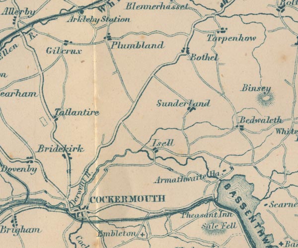
-- Armathwaite Hall -- "Armathwaite Ha." |
|
|
|
-- Bassenthwaite Lake -- "BASSENTHWAITE WR." |
|
|
|
-- Bewaldeth -- "Bedwaleth" |
|
|
|
-- Bothel -- "Bothel" |
|
|
|
-- Bridekirk -- "Bridekirk" |
|
|
|
-- Cockermouth -- "COCKERMOUTH" |
|
|
|
-- Cockermouth, Keswick and Penrith Railway |
|
|
|
-- Dash Beck |
|
|
|
-- Derwent, River -- "Derwent R." -- "Derwent
R." -- "Derwent R." -- "Derwent R." |
|
|
|
-- Gilcrux -- "Gilcrux" |
|
|
|
-- Isel -- "Isell" |
|
|
|
-- Pheasant, The -- "Pheasant Inn" |
|
|
|
-- Plumbland -- "Plumbland" |
|
|
|
-- Cockermouth to Carlisle |
|
|
|
-- Egremont to Cockermouth |
|
|
|
-- Keswick to Cockermouth |
|
|
|
-- Sunderland -- "Sunderland" |
|
|
|
-- Tallentire -- "Tallantire" |
|
|
|
-- Torpenhow -- "Torpenhow" |
|
|
civil parishes The area roughly includes parts of parishes:- Blindcrake Bridekirk Setmurthy Plumbland Cockermouth Oughterside and Allerby Bewaldeth and Snittlegarth Wythop Papcastle Embleton Brigham Blennerhasset and Torpenhow Gilcrux Bothel and Threapland |
||
|
|
||
|
|
Lakes Guides menu. | |