 Garnett 1850s-60s NY12


|

|
|
|
gazetteer links places may or may not be labelled on the map |
||

|
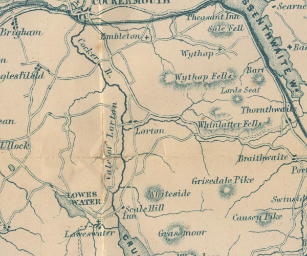
-- Cocker, River -- "Cocker R." |
|
|
|
-- Embleton -- "Embleton" |
|
|
|
-- Grisedale Pike -- "Grisedale Pike" |
|
|
|
-- High Lorton -- "Lorton" |
|
|
|
-- inn, Scale Hill -- "Scale Hill Inn" |
|
|
|
-- Lord's Seat -- "Lords Seat" |
|
|
|
-- Lorton Vale -- "Vale of Lorton" |
|
|
|
-- Loweswater -- "LOWES WATER" |
|
|
|
-- Loweswater -- "Loweswater" |
|
|
|
-- Sale Fell -- "Sale Fell" |
|
|
|
-- St Bartholomew's Church |
|
|
|
-- St Cuthbert's Church |
|
|
|
-- Whinlatter -- "Whinlatter Fells" |
|
|
|
-- Whiteside -- "Whiteside" |
|
|
|
-- Wythop Brows -- "Wythop Fells" |
|
|
|
-- Wythop Old Church |
|
|
|
-- Wythop -- "Wythop" |
|
|
civil parishes The area roughly includes parts of parishes:- Buttermere Above Derwent Loweswater Lorton Dean Lamplugh Cockermouth Blindbothel Embleton Wythop Brigham |
||
|
|
||
|
|
Lakes Guides menu. | |