 Old Cumbria Gazetteer
 |
 |
|
| Sale Fell, Wythop | ||
| Sale Fell | ||
| civil parish:- | Wythop (formerly Cumberland) | |
| county:- | Cumbria | |
| locality type:- | hill | |
| locality type:- | fell | |
| coordinates:- | NY19192970 (etc) | |
| 1Km square:- | NY1929 | |
| 10Km square:- | NY12 | |
| altitude:- | 1170 feet | |
| altitude:- | 357m | |
|
|
||
| evidence:- | old map:- OS County Series (Cmd 55 7) placename:- Sale Fell |
|
| source data:- | Maps, County Series maps of Great Britain, scales 6 and 25
inches to 1 mile, published by the Ordnance Survey, Southampton,
Hampshire, from about 1863 to 1948. |
|
|
|
||
| evidence:- | old map:- Garnett 1850s-60s H placename:- Sale Fell |
|
| source data:- | Map of the English Lakes, in Cumberland, Westmorland and
Lancashire, scale about 3.5 miles to 1 inch, published by John
Garnett, Windermere, Westmorland, 1850s-60s.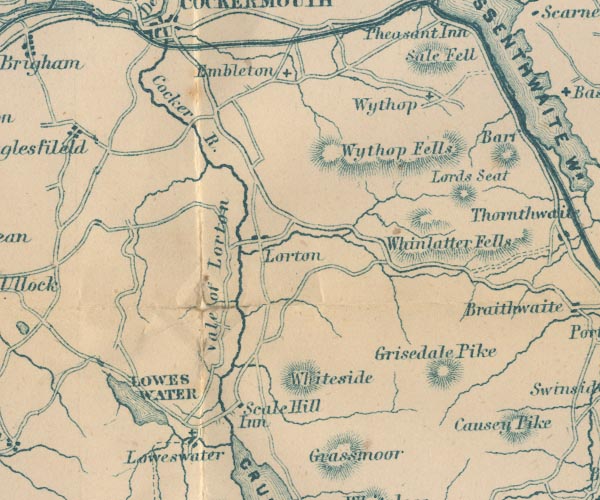 GAR2NY12.jpg "Sale Fell" hill hachuring item:- JandMN : 82.1 Image © see bottom of page |
|
|
|
||
| evidence:- | outline view:- Matthew 1866 placename:- Sale Fell |
|
| source data:- | Print, engraving, outline view, View from Watendlath Road of Derwent Water and Bassenthwaite,
Cumberland, published by J Richardson, Highgate, Kendal, Westmorland, 1866.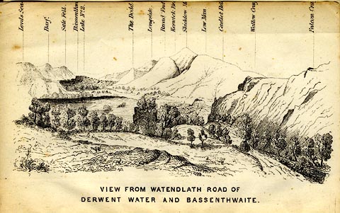 click to enlarge click to enlargeMW1E05.jpg Tipped in before p.1 of The English Lakes, Peaks and Passes, from Kendal to Keswick, by George King Matthew. printed at bottom:- "VIEW FROM WATENDLATH ROAD OF / DERWENT WATER AND BASSENTHWAITE." printed at caption to mountains:- "... Sale Fell. ..." item:- Armitt Library : A1168.5 Image © see bottom of page |
|
|
|
||
 Lakes Guides menu.