 Ford 1839 map SD77


|

|
|
|
gazetteer links places may or may not be labelled on the map |
||

|
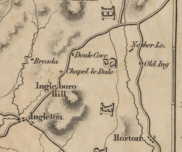
-- Braida Garth -- "Breada" |
|
|
|
-- Brunton House -- "Branton Hall" |
|
|
|
-- Chapel-le-Dale -- "Chapel le Dale" |
|
|
|
-- Clapham -- "Clapham" |
|
|
|
-- Giggleswick -- "Giggleswick" |
|
|
|
-- Great Douk Cave -- "Douk Cove" |
|
|
|
-- Horton in Ribblesdale -- "Horton" |
|
|
|
-- Ingleborough -- "Ingleboro Hill" |
|
|
|
-- Nether Lodge -- "Nether Lo." |
|
|
|
-- Old Ing -- "Old Ing" |
|
|
|
-- Old Toll Bar -- "Spirta Gate" |
|
|
|
-- Settle -- "SETTLE" |
|
|
|
-- Ebbing and Flowing Well -- "Ebbingwell" |
|
|
counties The area includes parts of counties:- North Yorkshire |
||
|
|
||
|
|
Lakes Guides menu. | |