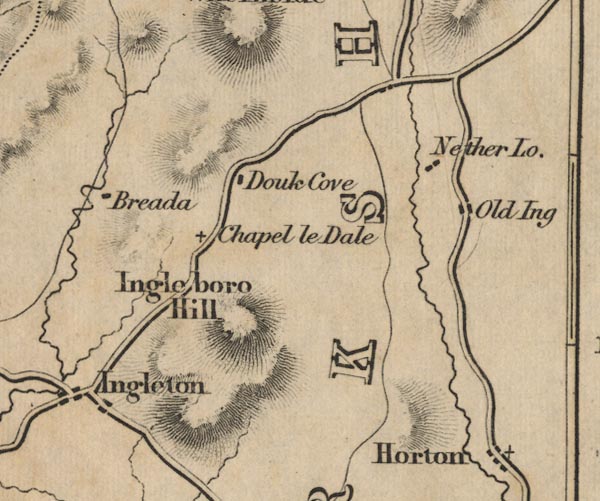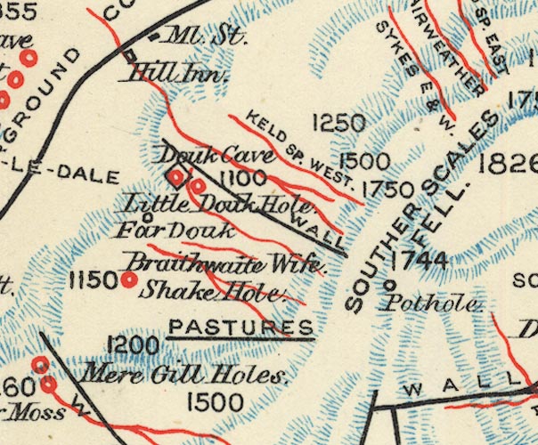


placename:- Douk Cave
 goto source
Tour to the Caves in the West Riding of Yorkshire, late 18th century
Page 255:- "About one hundred yards below the chapel [at Chapel-le-Dale] there are the ruins of an old cave, called Sandpot; ... If a descent were opened, no doubt but a subterranean passage would be discovered, leading either to the caves above the chapel, or, more probably, to Douk-cave, on the base of Ingleborough, if not to both."
 goto source
Page 261:- "..."
"... proceeded [from Weathercoat cave] to another, called Douk-Cove, about a mile south, on the other side of the turnpike road, towards the foot of Ingleborough, whose height now appeared to great advantage from the nature of our own elevated situation. Douk-cove is something similar to that of Weathercoat, but not heightened so much with the vast and terrible; the cavity, indeed, is longer and wider, but not deeper; the rocks not so high and steep, except on the east side, where the hawks and other birds build their nests, not dreading the approach of human foot. They both seem once to have been covered over, like Yordas; but the roofs have fallen in, by some inundation or other accident. The stream of this cascade does not fall above five or six yards, and is not so large as the former; though, like it, is immediately absorbed amongst the rocks beneath: the subterranean passage out of which it issues is very curious. By the help of a ladder we ascended, and went along it to some distance, by means of candles. When we had gone about forty or fifty yards, we came to a chasm twelve or fifteen yards in depth from the surface, through which we could see broad day. How far we could have proceeded we know not: we returned after we had been about an hundred yards. This would be looked on as a great curiosity in many countries; but after those we had seen, our wonder was not easily excited - No doubt but another subterranean passage might be discovered, by removing the rubbish at the bottom of the cave, where the water sinks. ..."
placename:- Douk Cave
 goto source
Page 201:- "..."
"DOUK CAVE is similar to Weathercote, but not heightened by anything so vast or sublime. It is longer and wider, but not so deep; and it lack sthe grand feature of the latter, the waterfall, though there is a small cascade issuing from the cavern. To get into this cavern, it is necessary to climb up the face of the cascade; and you find yourself in a long narrow passage with a lofty roof."
placename:- Douk Cove

FD02SD77.jpg
"Douk Cove"
item:- JandMN : 100.1
Image © see bottom of page
placename:- Douk Cave
item:- stalactite
 goto source
page 41:- "..."
"Douk Cave and Douk Hole Dell."
"Leaving the Whernside slopes of the valley and crossing over to the other side, so as to climb to the flat top of the Ingleborough scars behind the Hill Public-house, we find a marvellous but diminutive mountain dell, elliptical in form and surrounded on all sides, except a portion of the foot, by vertical precipices sixty feet in height close to the"
 goto source
page 42:- "mouth of the cave, and at the foot blocked in by a precipitous and rugged incline - certainly a trifle less formidable. A mountain stream, not always puny, enters the dell at its upper end and issues from the base of the limestone crag, running down the fairy vale, hemmed in by the desert mountain, but ere it reaches the lower end sinking from sight amid the stones forming its pebbly bed; at the twilight hour the dim outline of savage rocks and the gloom of the valley make the place appear as though nature had formed it for a robber's lair, if not his stronghold."
"The brook issues from a remarkably fine cave, which, however, is not pleasantly accessible to the bulk of tourists, as a stream of no inconsiderable dimensions traverses its whole extent, excepting a very small loft close to the mouth. To enter by the apparent mouth the cave-hunter has to clamber up the sides of the cascade debouching from the conspicuous entrance; but on looking upwards a ledge of rock is seen some distance above, on climbing up to which a second opening is found entering another branch or upper story of the cave, where no stream is, and leading by a passage to the main cavern. Candles and matches must be provided in abundance, as drops of water trickling from the roof may suddenly extinguish the little luminary. After picking the way carefully to avoid pools and streams, and proceeding about fifty yards, daylight is seen above and a circular opening - Little Douk Hole - is descried aloft, a great distance over head - forty-five feet - whilst bones of rabbits, sheep, and other creatures that have met their fate by tumbling headlong down the abyss lie scattered upon the broad bottom. The cave in the lower area is narrow - except at this point - but lofty, although not so contracted as most of the caverns in these mountains; it is fluted with stalactitic plates,"
 goto source
page 43:- "yet the true stalactites and stalagmites have, in a great measure, been broken off by the pilfering hands of contemptible miscreants. Further and further we advance, until it seems as though we should soon be in the great ridge of Ingleborough itself, so long appears the way, so slowly does time seem to pass in this infernal, dark retreat. The roof above, now flat, becomes depressed, or rather the floor of the cavern gradually rises, so that at the last the head has to be lowered; and then the waters become sundered by bifurcating passages, and the subterranean river is found to have its branches like a subaerial stream. Following the ramifications, stooping with lowered back, at length the onward course must cease, unless the enthusiastic lover of mysteries be enthusiast enough to creep along amongst the trickling waters. This is the finest cave in the district which is easily accessible and free to the public; it is, in fact, much superior to some other places for admittance to which a charge is made."
placename:- Douk Cave

BS1SD77N.jpg
"DOUK CAVE"
item:- private collection : 27.1
Image © see bottom of page
