|
 |
|
|
placename:-
|
Horton in Ribblesdale
|
|
county:-
|
North Yorkshire
|
|
|
building/s
|
|
coordinates:-
|
SD8072
|
|
10Km square:-
|
SD87
|
|
|
|
1Km square |
SD8072 |
|
|
|
old map:- |
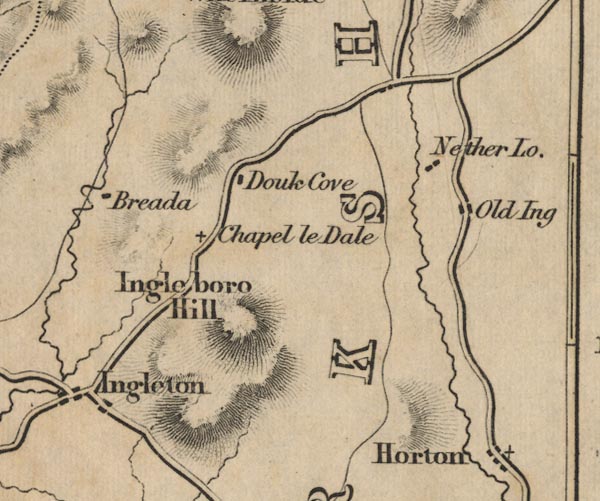
Ford 1839 map
|
|
|
Map of the Lake District, published in A Description of
Scenery in the Lake District, by William Ford, published by
Charles Thurnham, London, 1839. |
|
|
|
|
|
Horton
|
| |
|
|
placename:-
|
Horton
|
|
county:-
|
Yorkshire
|
|
date:-
|
1839
|
|
period:-
|
19th century, early; 1830s
|
|
|
|
descriptive text:- |
West 1778 (11th edn 1821)
|
|
|
Guide book, A Guide to the Lakes, by Thomas West,
published by William Pennington, Kendal, Cumbria once
Westmorland, and in London, 1778 to 1821. |
| |
goto source.
|
|
|
Tour to the Caves in the West Riding of Yorkshire, late
18th century
|
|
|
Page 274:-
|
|
|
...
|
|
|
... along the banks of the river Ribble, four or five miles
farther, to the village of Horton, situated at the bottom of
the lofty and elegant mountain Pennegant.
|
| |
goto source.
|
|
|
Page 275:-
|
|
|
...
|
|
|
Before we left Horton we visited some natural curiosities of
the cavern kind on the base of Pennegant.[1] Dowgill-scar, a
little above Horton, ... [and] About a mile or two above
Horton, upon the base of Pennegant, we visited Hulpit and
Huntpit-holes. ...
|
| |
|
|
placename:-
|
Horton
|
|
date:-
|
1760
|
|
period:-
|
18th century, late; 1760s
|
|
|
|
|
Horton Beck |
|
|
|
Old Cumbria Gazetteer - JandMN: 2013
|
|
|