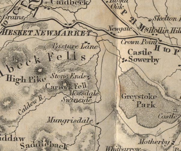
 Ford 1839 map NY33


|

|
|
|
gazetteer links places may or may not be labelled on the map |
||

|
-- Caldbeck Fells -- "Caldbeck Fells" |
|
|
|
-- Caldew, River -- "Caldew R." |
|
|
|
-- Carrock Fell -- "Carrock Fell" |
|
|
|
-- Castle Sowerby -- "Castle Sowerby" |
|
|
|
-- Greystoke Castle -- "Greystoke Park" --
"Castle" |
|
|
|
-- Hesket Newmarket -- "HESKET NEWMARKET" |
|
|
|
-- High Pike -- "High Pike" |
|
|
|
-- Mosedale -- "Mossdale" |
|
|
|
-- Mungrisdale -- "Mungrisdale" |
|
|
|
-- Newgate Inn (?) -- "Newgate" |
|
|
|
-- Pasture Lane -- "Pasture Lane" |
|
|
|
-- Penrith to Hesket Newmarket -- "H to P 13 Ms." |
|
|
|
-- Penrith to Wigton -- "W to P 21 Ms." |
|
|
|
-- Skelton Wood End -- "Skelton End" |
|
|
|
-- Stone Ends -- "Stone Ends" |
|
|
|
-- Swineside -- "Swinside" |
|
|
civil parishes The area roughly includes parts of parishes:- Underskiddaw Caldbeck Mungrisdale Castle Sowerby Sebergham Greystoke Skelton |
||
|
|
||
|
|
Lakes Guides menu. | |