Old Cumbria Gazetteer
 |
 |
|
||
| Swineside, Mungrisdale | ||||
| Swineside | ||||
| civil parish:- | Mungrisdale (formerly Cumberland) | |||
| county:- | Cumbria | |||
| locality type:- | locality | |||
| locality type:- | buildings | |||
| coordinates:- | NY34103246 (etc) | |||
| 1Km square:- | NY3432 | |||
| 10Km square:- | NY33 | |||
|
|
||||
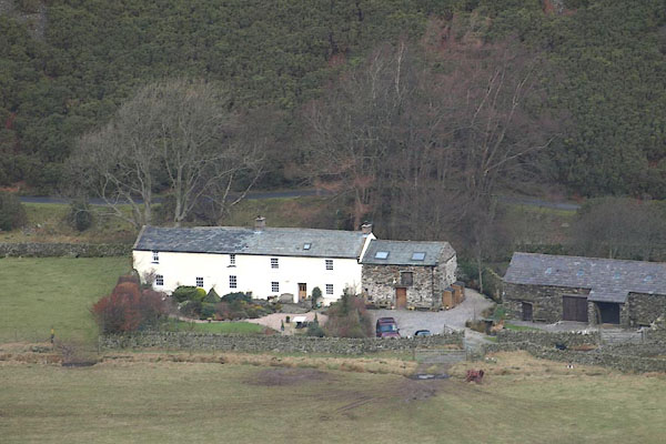
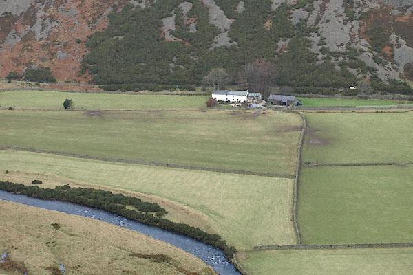 BOK95.jpg (taken 6.2.2008) |
||||
|
|
||||
| evidence:- | old map:- OS County Series (Cmd 48 13) placename:- Swineside |
|||
| source data:- | Maps, County Series maps of Great Britain, scales 6 and 25
inches to 1 mile, published by the Ordnance Survey, Southampton,
Hampshire, from about 1863 to 1948. |
|||
|
|
||||
| evidence:- | probably old text:- Gents Mag placename:- Swinstead item:- sunshine |
|||
| source data:- | Magazine, The Gentleman's Magazine or Monthly Intelligencer or
Historical Chronicle, published by Edward Cave under the
pseudonym Sylvanus Urban, and by other publishers, London,
monthly from 1731 to 1922. goto source goto sourceGentleman's Magazine 1747 p.522 "[on the way to Caldbeck Fells] ... the neighbourhood of Mose-dale; here I found villages in the narrow bottoms, that feel no more benefit from the solar rays for two months about the winter solstice, than the old Cimmerians, or the Laplanders who inhabit about the North Cape of Norway." "Swinsted on Cauda is a strong instance that the property of the Artic circle is not confined to those unhappy regions which lie within 23 degrees of the pole, especially with regard to the solar light." |
|||
|
|
||||
| evidence:- | old map:- Gents Mag 1747 placename:- Swinsted |
|||
| source data:- | Map, uncoloured engraving, perspective view, Caudbeck Fells ie
Caldbeck Fells, scale about 1+ miles to 1 inch, published in the
Gentleman's Magazine, 1747.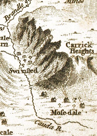 GM1406.jpg "Swinsted" buildings item:- Carlisle Library : Map 43 Image © Carlisle Library |
|||
|
|
||||
| evidence:- | old text:- Gents Mag 1747 placename:- Swinsted |
|||
| source data:- | Map, perspective view, Caudbeck Fells ie Caldbeck Fells, scale about 1+ miles to 1
inch, and descriptive text, published in the Gentleman's Magazine, November 1747. goto source Page 522:- "... villages in the narrow bottoms, that feel no more benefit from the solar rays for two months about the winter solstice, than the old Cimmerians, or the Laplanders who inhabit about the North Cape of Norway. Swinsted on Cauda is a strong instance that the property of the Artic circle is not confined to those unhappy regions which lie within 23 degrees of the pole, especially with regard to the solar light." |
|||
|
|
||||
| evidence:- | old map:- Donald 1774 (Cmd) placename:- Swinside |
|||
| source data:- | Map, hand coloured engraving, 3x2 sheets, The County of Cumberland, scale about 1
inch to 1 mile, by Thomas Donald, engraved and published by Joseph Hodskinson, 29
Arundel Street, Strand, London, 1774.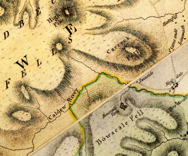 D4NY33SW.jpg "Swinside" block or blocks, labelled in lowercase; a hamlet or just a house item:- Carlisle Library : Map 2 Image © Carlisle Library |
|||
|
|
||||
| evidence:- | old map:- Ford 1839 map placename:- Swinside |
|||
| source data:- | Map, uncoloured engraving, Map of the Lake District of
Cumberland, Westmoreland and Lancashire, scale about 3.5 miles
to 1 inch, published by Charles Thurnam, Carlisle, and by R
Groombridge, 5 Paternoster Row, London, 3rd edn 1843.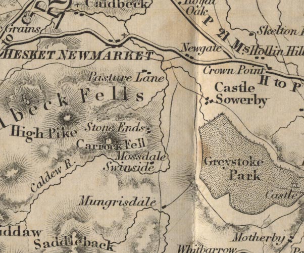 FD02NY33.jpg "Swinside" item:- JandMN : 100.1 Image © see bottom of page |
|||
|
|
||||
| places:- |
|
|||
Lakes Guides menu.