 Ford 1839 map NX91


|

|
|
|
gazetteer links places may or may not be labelled on the map |
||

|
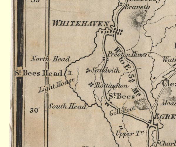
-- Coulderton -- "Upper Tn." |
|
|
|
-- Gillfoot -- "Gill Foot" |
|
|
|
-- North Head -- "North Head" |
|
|
|
-- Prestonhows -- "Preston Haws" |
|
|
|
-- Cockermouth to Whitehaven -- "W to C 14 Ms." |
|
|
|
-- Egremont to Whitehaven -- "W to E 5 3/4 Ms." |
|
|
|
-- Whitehaven to Workington -- "W to W 7 1/2 Ms." |
|
|
|
-- Rottington -- "Rottington" |
|
|
|
-- Sandwith -- "Sandwith" |
|
|
|
-- South Head -- "South Head" |
|
|
|
-- St Bees Head -- "St. Bees Head" |
|
|
|
-- St Bees Lighthouse -- "Light House" |
|
|
|
-- St Bees -- "St. Bees" |
|
|
|
-- Whitehaven -- "WHITEHAVEN" |
|
|
civil parishes The area roughly includes parts of parishes:- Egremont Whitehaven St Bees Weddicar Parton Moresby |
||
|
|
||
|
|
Lakes Guides menu. | |