 Crosthwaite 1783-94, tetrad SD39W

|

|
|
|
gazetteer links places may or may not be labelled on the map |
||

|
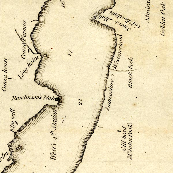
-- Black Beck -- "Black beck" -- "Westmorland /
Lancashire" |
|
|
|
-- Cunsey Furnace -- "Cunza Furnace" |
|
|
|
-- Ghyll Head -- "Gill head / Mr. John Pool's" |
|
|
|
-- Grass Holme -- "Grass holm" |
|
|
|
-- Holme Well -- "Elm well" |
|
|
|
-- Lancashire, North of the Sands -- "Lancashire" --
"Lancashire" |
|
|
|
-- Ling Holme -- "Ling holm" |
|
|
|
-- Low Cunsey Farm -- "Cunza house" |
|
|
|
-- Rawlinson Nab -- "Rawlinson's Nab" |
|
|
|
-- Windermere lake -- "West's 4th. Station" |
|
|
|
-- Storrs Hall -- "Storrs Hall / Coll. Boulton" |
|
|
|
-- Westmorland -- "Westmorland" --
"Westmorland" |
|
|
civil parishes The area roughly includes parts of parishes:- Windermere Cartmel Fell Satterthwaite Claife |
||
|
|
||
|
|
Lakes Guides menu. | |