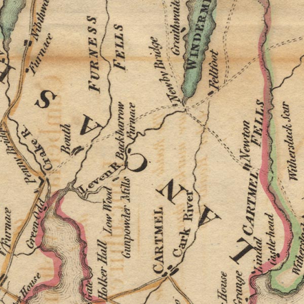
 West 1784 map SD38


|

|
|
|
gazetteer links places may or may not be labelled on the map |
||

|
-- Backbarrow Ironworks (?) -- "Backbarrow /
Furnace" |
|
|
|
-- Backbarrow -- "Backbarrow / Furnace" |
|
|
|
-- Bouth |
|
|
|
-- Eea, River |
|
|
|
-- Fell Foot |
|
|
|
-- Furness Fells -- "FURNESS FELLS" |
|
|
|
-- High Newton |
|
|
|
-- Leven Estuary |
|
|
|
-- Leven, River -- "Leven R." |
|
|
|
-- Low Wood |
|
|
|
-- Lowwood Gunpowder Mills -- "Gunpowder Mills" |
|
|
|
-- Newby Bridge |
|
|
|
-- Newton Fell -- "CARTMELL FELLS" |
|
|
|
-- Rusland Pool |
|
|
|
-- Windermere lake -- "WINDERMERE WATER" |
|
|
civil parishes The area roughly includes parts of parishes:- Cartmel Fell Lower Allithwaite Broughton East Haverthwaite Colton Lowick Hawkshead Egton with Newland Staveley-in-Cartmel Upper Allithwaite Windermere Satterthwaite |
||
|
|
||
|
|
Lakes Guides menu. | |