 Old Cumbria Gazetteer
 |
 |
|
| Furness Fells | ||
| civil parish:- | Colton (formerly Lancashire) | |
| county:- | Cumbria | |
| locality type:- | hill | |
| locality type:- | fell | |
| 1Km square:- | SD3389 (etc) | |
| 10Km square:- | SD38 | |
|
|
||
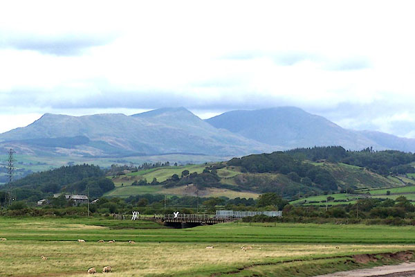 BMO90.jpg From Kirkby in Furness Station. (taken 30.8.2006) |
||
|
|
||
| evidence:- | old map:- Saxton 1579 placename:- Fournes Fells |
|
| source data:- | Map, hand coloured engraving, Westmorlandiae et Cumberlandiae Comitatus ie Westmorland
and Cumberland, scale about 5 miles to 1 inch, by Christopher Saxton, London, engraved
by Augustinus Ryther, 1576, published 1579-1645.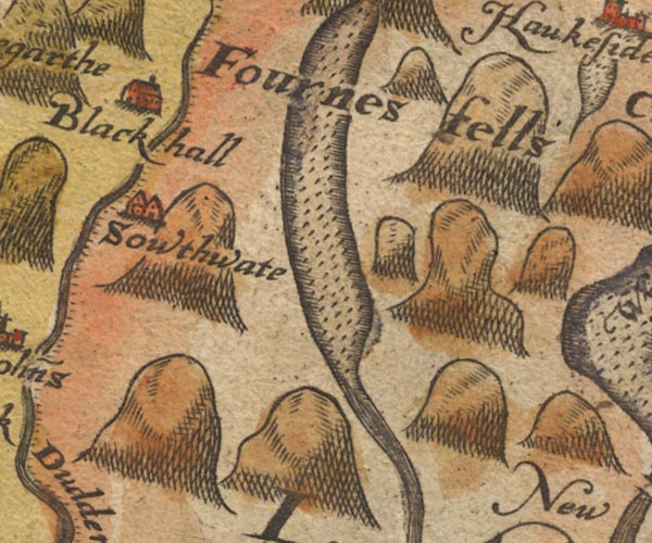 Sax9SD29.jpg "Fournes fells" item:- private collection : 2 Image © see bottom of page |
|
|
|
||
| evidence:- | old map:- Mercator 1595 (edn?) placename:- Fournes Fels |
|
| source data:- | Map, hand coloured engraving, Westmorlandia, Lancastria, Cestria
etc, ie Westmorland, Lancashire, Cheshire etc, scale about 10.5
miles to 1 inch, by Gerard Mercator, Duisberg, Germany, 1595,
edition 1613-16.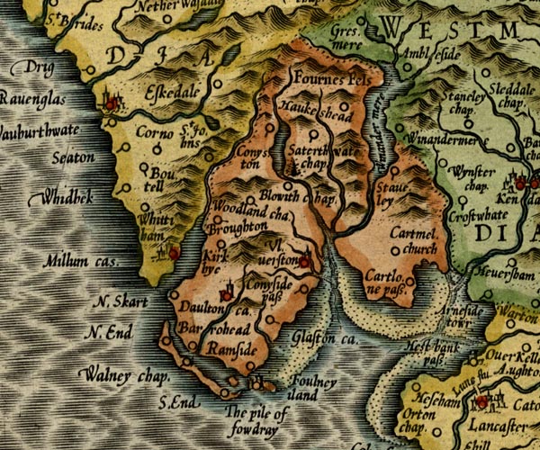 MER5LanA.jpg "Fournes Fels" area item:- Armitt Library : 2008.14.3 Image © see bottom of page |
|
|
|
||
| evidence:- | old map:- Speed 1611 (Cmd) placename:- Fournes Felds |
|
| source data:- | Map, hand coloured engraving, Cumberland and the Ancient Citie
Carlile Described, scale about 4 miles to 1 inch, by John Speed,
1610, published by J Sudbury and George Humble, Popes Head
Alley, London, 1611-12.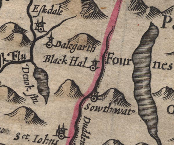 SP11SD29.jpg "Part of Fournes Felds" hillocks; Lancashire item:- private collection : 16 Image © see bottom of page |
|
|
|
||
| evidence:- | old map:- Speed 1611 (Wmd) placename:- Fournes Fells |
|
| source data:- | Map, hand coloured engraving, The Countie Westmorland and
Kendale the Cheif Towne, scale about 2.5 miles to 1 inch, by
John Speed, 1610, published by George Humble, Popes Head Alley,
London, 1611-12.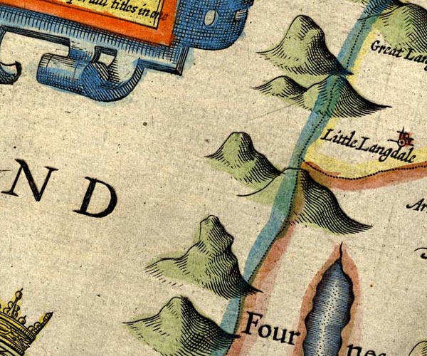 SP14NY20.jpg 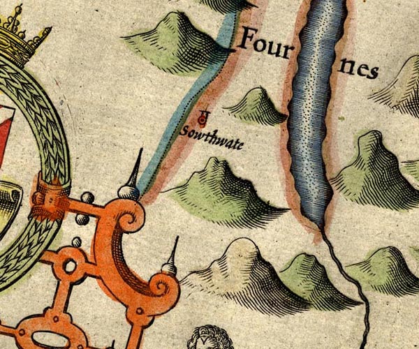 SP14SD29.jpg  SP14SD39.jpg "Fournes Fells" hillocks item:- Armitt Library : 2008.14.5 Image © see bottom of page |
|
|
|
||
| evidence:- | poem:- Drayton 1612/1622 text item:- tree geese; Barnacle geese; geese |
|
| source data:- | Poem, Poly Olbion, by Michael Drayton, published by published by
John Marriott, John Grismand and Thomas Dewe, and others?
London, part 1 1612, part 2 1622. goto source goto sourcepage 136:- "... mighty Neptune bare, Whose Fells to that grim god, most sterne and dreadfull are, With Hills whose hanging browes, with Rockes about are bound, Whose weighty feet stand fixt in that black beachy ground, Whereas those scattered trees, which naturally partake, The fatnesse of the soyle (in many a slimy Lake, Their roots so deeply sok'd) send from their stocky bough, A soft and sappy Gum, from which those Tree-geese grow, Call'd Barnacles by us, which like a Jelly first To the beholder seeme, then by the fluxture nurst, Still great and greater thrive, untill you well may see Them turn'd to perfect Fowles, when dropping from the tree Into the Meery Pond, which under them doth lye, Waxe ripe, and taking wing, away in flocks doe flye; Which well our Ancients did among our Wonders place: ..." goto sourcepage 165:- "... Great Fournesse mighty Fells ..." |
|
|
|
||
| evidence:- | old map:- Jansson 1646 placename:- Fournes Fells |
|
| source data:- | Map, hand coloured engraving, Cumbria and Westmoria, ie
Cumberland and Westmorland, scale about 3.5 miles to 1 inch, by
John Jansson, Amsterdam, Netherlands, 1646. JAN3SD29.jpg "Fournes fells" 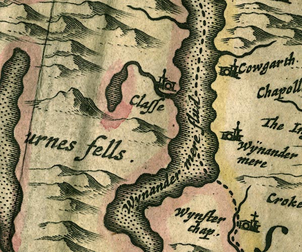 JAN3SD39.jpg Labelling the area, no symbol. item:- JandMN : 88 Image © see bottom of page |
|
|
|
||
| evidence:- | old map:- Seller 1694 (Wmd) placename:- Fourness Fells |
|
| source data:- | Map, hand coloured engraving, Westmorland, scale about 8 miles
to 1 inch, by John Seller, 1694. click to enlarge click to enlargeSEL7.jpg "Fourness Fells" no symbol; hills item:- Dove Cottage : 2007.38.87 Image © see bottom of page |
|
|
|
||
| evidence:- | old map:- Morden 1695 (Cmd) placename:- Fourness Fels |
|
| source data:- | Map, uncoloured engraving, Cumberland, scale about 4 miles to 1
inch, by Robert Morden, 1695, published by Abel Swale, the
Unicorn, St Paul's Churchyard, Awnsham, and John Churchill, the
Black Swan, Paternoster Row, London, 1695-1715.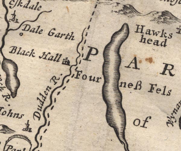 MD12SD29.jpg "Fourness Fels" Area, no symbol. item:- JandMN : 90 Image © see bottom of page |
|
|
|
||
| evidence:- | old map:- Morden 1695 (Wmd) placename:- Fournes Fells |
|
| source data:- | Map, hand coloured engraving, Westmorland, scale about 2.5 miles to 1 inch, by Robert
Morden, published by Abel Swale, the Unicorn, St Paul's Churchyard, Awnsham, and John
Churchill, the Black Swan, Paternoster Row, London, 1695.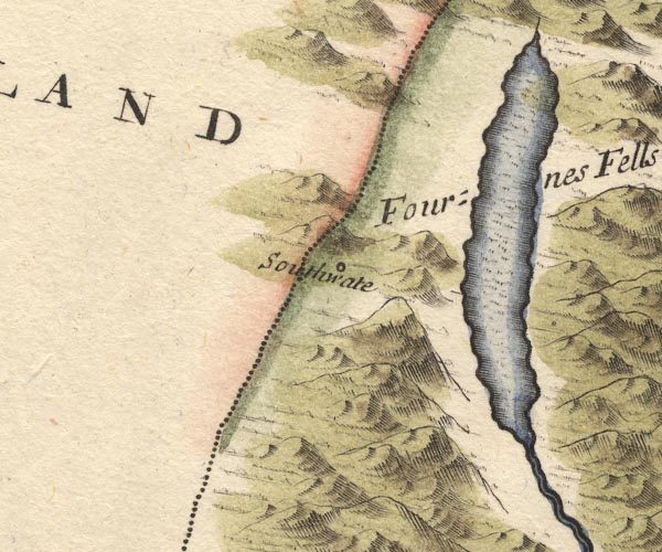 MD10SD29.jpg "Fournes Fells" Hillocks. item:- JandMN : 24 Image © see bottom of page |
|
|
|
||
| evidence:- | descriptive text:- Fiennes 1698 placename:- Furness Fells placename:- Donum Fells |
|
| source data:- | Travel book, manuscript record of Journeys through England
including parts of the Lake District, by Celia Fiennes, 1698. "... a standing lake [Windermere] encompass'd with vast high hills that are perfect rocks and barren ground of a vast height from which many little springs out of the rock does bubble up and descend down and fall into this water; ... these hills which they call Furness Fells a long row continued some miles and some of them are call'd Donum Fells and soe from the places they adjoyne to are named, but they hold the whole length of the water which is 10 mile; they have some parts of them that has wayes that they can by degrees in a compass ascend them and so they go onward in the countrys; ..." "..." "Their little carts I was speakeing of they use hereabout, the wheeles are fast'ned to the axletree and so turn altogether, they hold not above what our wheele barrows would carry at three or four tymes, which the girles and boys and women does go about with, drawn by one horse to carry any thing they want; here is a great deal of good grass and summer corn and pastures its rich land in the bottoms, as one may call them considering the vast hills above them on all sides, yet they contain a number of lesser hills one below another, so that tho' at one looke you think it but a little land every body has, yet it being so full of hills its many acres which if at length in a plain would extend a vast way; ..." |
|
|
|
||
| evidence:- | descriptive text:- Fiennes 1698 placename:- Furness Hills |
|
| source data:- | Travel book, manuscript record of Journeys through England
including parts of the Lake District, by Celia Fiennes, 1698. "on the Castle tower walking quite round by the battlements I saw ... into Westmoreland to the great hills there call'd Furness Fells or Hills being a string of vast high hills together; ..." |
|
|
|
||
| evidence:- | descriptive text:- Defoe 1724-26 placename:- Fourness Fells |
|
| source data:- | Tour through England and Wales, by Daniel Defoe, published in
parts, London, 1724-26. "... the west side [of Westmorland], which borders on Cumberland, is indeed bounded by a chain of almost unpassable mountains, which, in the language of the country, are called Fells, and these are called Fourness Fells, from the famous promontory bearing that name, ..." |
|
|
|
||
| evidence:- | old map:- Simpson 1746 map (Wmd) placename:- Fourness Fells |
|
| source data:- | Map, uncoloured engraving, Westmorland, scale about 8 miles to 1
inch, printed by R Walker, Fleet Lane, London, 1746.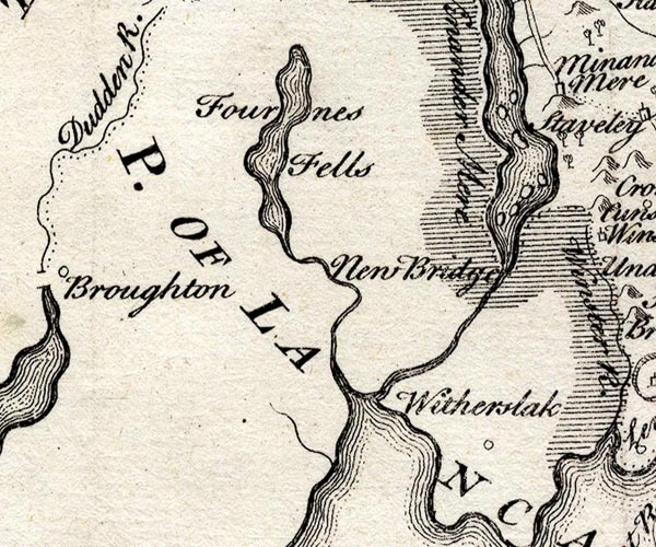 SMP2SDJ.jpg "Fourness Fells" Area. item:- Dove Cottage : 2007.38.59 Image © see bottom of page |
|
|
|
||
| evidence:- | old map:- Bowen and Kitchin 1760 placename:- Fourness Fells |
|
| source data:- | Map, hand coloured engraving, A New Map of the Counties of
Cumberland and Westmoreland Divided into their Respective Wards,
scale about 4 miles to 1 inch, by Emanuel Bowen and Thomas
Kitchin et al, published by T Bowles, Robert Sayer, and John
Bowles, London, 1760.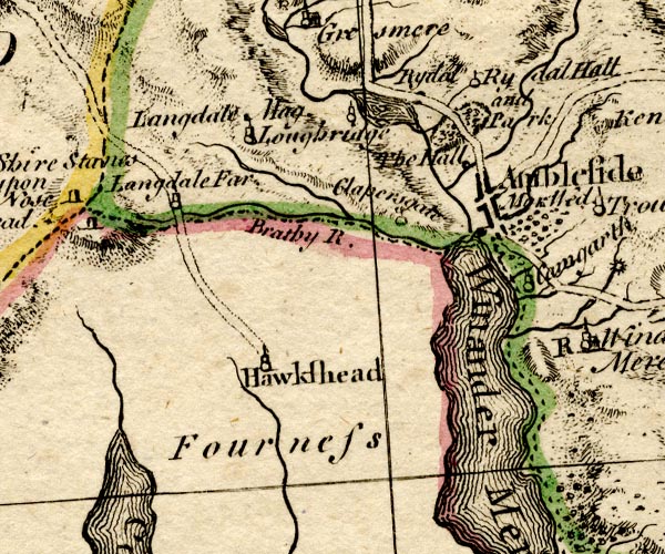 BO18SD29.jpg "Fourness [Fells]" area 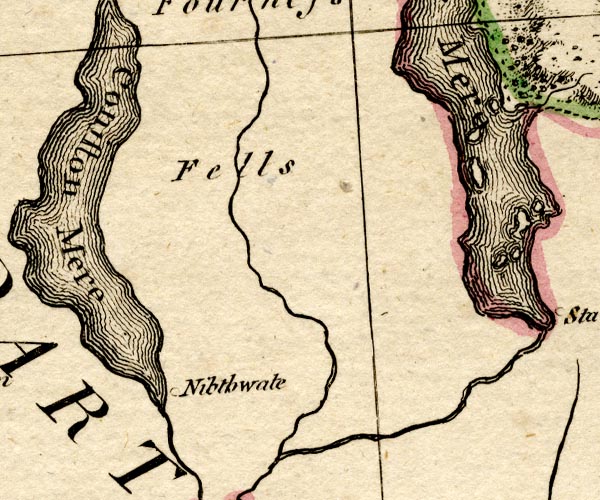 BO18SD28.jpg "[Fourness] Fells" item:- Armitt Library : 2008.14.10 Image © see bottom of page |
|
|
|
||
| evidence:- | descriptive text:- West 1778 (11th edn 1821) placename:- Furness Fells item:- eminences; objects; trees |
|
| source data:- | Guide book, A Guide to the Lakes, by Thomas West, published by
William Pennington, Kendal, Cumbria once Westmorland, and in
London, 1778 to 1821. goto source ARTICLE VIII Further Account of Furness Fells; OR, OBSERVATIONS ON PLACING OBJECTS ON THE EMINENCES, AND PLANTING TREES IN THE VALLIES SEEN IN THIS TOUR. BEING THE NOTE INTENDED FOR P.43. Page 284:- "FURNESS FELLS, and the adjacent parts here alluded to, are so peculiarly distinguished with picturesque beauty, that they deserve a more minute description. This country consists of a succession of mountains and vallies formed and intermixed in all the possible variety of rural nature. Much of the vallies, and the bases of most of the hills, are covered with young wood, which, at certain periods, is cut down and charred for the use of the neighbouring furnaces. On this account, the copses, which consist of various kinds of trees, constantly, in the summer, exhibited every pleasing colour of youthful vegetation. The main shoots also spring up so straight, and the collateral ones at such small angles with them, that they give an uncommon idea of vegetating vigour; and when they are seen rooted in the different clefts of rocks, fancy will conceive them not unlike the stream of some fluid bursting forcibly from its prison. Amongst these copses are found several neat villages, houses, and spaces of cultivated land, which, with a number of brooks and rivers tumbling and tinkling among them, constitute a scene of sylvan beauty exceedingly lively and singular. But what still enhances the whole, is the goodness of the highways, of which, in fine weather, it is not extravagant to say, in general, that they" goto sourcePage 285:- "are more like the walks of a gentleman's pleasure ground, than roads for ordinary occupation. This circumstance, though in part owing to the peculiar goodness of the materials, is, nevertheless, much indebted to the neatness and public spirit of the inhabitants. A laudable taste for adorning nature has led us from ornamented gardens to ornamented farms, and being in the possession of good roads (an essential article for the display of rural beauty) there seems to be but one thing wanting to make this a truly ornamental country. What I mean here is, artificial objects raised on proper parts of the mountains and eminences, which at every turn are presented to us through some agreeable opening or other. Eminences are as naturally fit places for objects intended to attract the distant eye, as they are for enabling the eye to survey distant objects. Hence, to decorate them with columns, obelisks, temples, &c, has the sanction of natural fitness. And if to this consideration we add that of the inherent beauty of the objects themselves, and remember, that there is nothing sets off the beauties of nature so much as elegant works of art; justifying motives for these erections can never be wanting to any one who has a taste for rural beauty, and is willing to accomplish as much of it as is in his power. But this is not all: the practice is certainly patriotic: for such elegant ornaments will at least naturally contribute to diffuse a serenity and cheerfulness of mind into every beholder; and thence (if we may be allowed the figure) like clectrical (sic) conductors, they may be supposed to bring down a little of the happy placidity of better regions, to add to the natural quantity shooting about on the earth. As another motive, it may be observed, that it is pleasing, in any country, to see the inhabitants so much at ease in mind and circumstances, as to pay attention to these fanciful undertakings; and moreover, that as a man of sense appears the more so for seeming conscious of the importance of what he says, so every traveller will conceive the better of a people, who, sensible" goto sourcePage 286:- "of the natural advantages of their country, are found disposed to make the best of them. How these objects should be formed, or situated, must for the most part be determined by circumstances under the eye of taste. One thing, however, seems worthy of particular notice in this place, which is, that erections of this sort would have the most grand and characteristic effect placed on eminences, so as to have the sky for a back-ground. When this is the case, the hills they are raised upon should be bounded by agreeable lines, seen at a great distance, and much in sight of the principal roads [1]. The most simple of these erections are obelisks, and properly formed summer-houses [2]. But a series of columns constituting a temple, or supporting arches, pediments, &c would have by much the best effect, provided they were properly large, for the ordinary points of view. Through the openings of these columns, the sky should always give them a striking appearance: but in an evening, if the sun set behind them, no spectacle of the kind could be imagined more grand and attractive, or more accordant with the sublimity of the surrounding mountains. Perforated doors and windows, in the " "" "[1] If they be not intended also for a near inspection, they need not be of any expensive materials. Provided they be well formed in outline (and for the design of which, artists of taste should always be applied to) common stone and mortar will do very well." "[2] This kind of summer-house should either be octagonal, or at least have more than four sides. And if either of these sort of erections be not placed on very pointed hills, care should be taken to raise them (either by raising the earth on which they stand, or by giving them a high rustic base, &c.) so that the sides of the hills will not prevent a complete sight of their elevation from the principal points of view.- Nothing can be worse managed, than to see these objects as if rising beyond the top of a hill, or from the bottom of a fish-pond. Perhaps a summer-house standing on proper rustic arches, through which the sky might be seen, would, for the following reason, in some cases, have good effect." goto sourcePage 287:- "imitation of old Gothic ruins, it is true, would yield part of this effect; but their gloomy and irregular appearance renders them, in the case before us, generally improper. Something of this kind (on the bolder eminences particularly) seems to be the only essential article that is wanting to perfect the rural beauties of this country; except, indeed, it may be thought, that a little more attention paid to the removal and planting of trees, would be of use for that end; and concerning which I beg leave to lengthen this article with a few observations. Trees are certainly the ornament and pride of vegetable nature. A bird despoiled of its plumage scarcely seems more mutilated and ungainly, than countries and inclosures destitute of trees. They have a good effect planted even (in their worst situation) any-how in hedge-rows; but if they be lightly scattered, with taste, in proper parts of the inclosure itself, they become infinitely more pleasing. Hence, though nature has done wonders in the disposition of trees in some of her favourite haunts, yet still (if not in them) she may be improved upon in others, by the assistance of art. And let not the lips of Sordidness object to the purport of this hint, that if put in practice, it would ask some care and expense, and probably prevent the growth of what is more profitable to the owner, and servicable to man; for the God of nature has far from having fully proportioned the animals of the earth to its produce: and as he renders fruitless innumerable seeds of almost every vegetable and animal creature, so the application of a part of our care, and a portion of the earth, to its own ornament, is, I am persuaded, so far from being culpable or improper, that (in humble imitation of the divine love of beauty and liberality) it seems to be as much required from the pious votary of nature, as his admiration of what comes immediately from its own efforts. In both cases God is alike honoured; and honour to God is certainly too nearly connected with religion to make it in any case an act of in-" goto sourcePage 288:- "[in]difference. Do then, ye affluent and prosperous landholders, pay some attention to this particular. Study the subject, through the medium of books and pictures; and sometimes spare, and sometimes plant a tree for ornament's sake. And (if you think them reasonable ones) observe all the following remarks, humbly offered to your consideration. They shall be made as brief as possible. The greatest nicety and perfection in the art of planting trees, lies in the use of exotics, and an ingenious mixture of foliage, in order to decorate, for near inspection, the marginal views of a lawn, walk, &c. But if ever a fondness for agriculture, built upon a love of simple nature and sober piety (of which there are too, too few indications in our present manners) shall turn the general taste of the kingdom towards ornamented farms, such an event cannot be supposed to be suddenly brought about: hence the precepts that relate to this elegant part of gardening, will in this place be wholly unnecessary, and our attention must be confined to the management of larger trees, which are already found in these regions. Scotch firs, though a favourite tree with many people, seem to require a good deal of judgment in their use; for they may be so planted as to injure a landscape more perhaps than they are generally seen to adorn it. In hanging woods (with which this country abounds) they frequently appear to disadvantage, however disposed. A single tree in this case often looks like a blot, and a plantation like a daub; especially in winter, when the most is expected from their verdure. The reason of this seems to be the darkness of their colour, and the obviousness of their whole form and outline: from the first particular they always attract the eye more than any thing else; and form the second, hurt the imagination with presenting to it only a parcel of small limited streaks or patches, awkwardly inclined to the horizon. When slightly and irregularly interspersed with woods of this kind, they" goto sourcePage 289:- "may now and then please from variety; but in general they come so forward to the eye, and at a good distance in winter so much resemble yew, holly, and the like gloomy and barren looking trees, that they do a real injury to the soft and pleasing tints, which result from the native stems, and which, from use, best accord with the idea of thriving woodlands. For these reasons, Scotch firs look best when they are seen in large horizontal plantations, on low (or at least not high) ground; when the front only is exposed to sight (hence their depth backward imagined very great) and when the blue vapours of an extended horizon are seen over their tops: in this case they have a very grand effect, and form a fine dark contrast to the pale and distinct features of the overlooking hills. Those circular groups of trees called clumps, are oftener seen than worthy of praise. They appear to have the best effect (if they must be used) for near views, or when they are found in the middle of a level open vale of fine lawn or meadow; but on the sides of distant hills or mountains (where they are seen all round) their appearance is truly paltry. The more smooth and large these eminences are, the more improper this species of ornament becomes; and, in short, I apprehend that the features of a lady's face would scarcely be more injured by the mark of her thimble, than the features of several hills would be by these unnatural circles. At the same time, however, that we censure this mode of decorating mountains, it may be proper to observe, that if they be wholly covered with wood, or lightly interspersed with single trees, the effect will be natural and pleasing. But the most absurd decoration of these eminences in vogue, is a few trees planted on their top, so that the whole boles of the foremost ranks may be seen, down to their very roots. Trees, we know, are chiefly the produce of the lower parts of the earth's surface; and to see the roots of some above the heads of others, as it were, tier above tier, is not" goto sourcePage 290:- "natural, and therefore not beautiful. Houses, which are the work of art, seldom look well in this form. In short, whatever be the circumstances of the base of a fine mountain as to wood, its top should either be wholly naked, or ornamented with one of those artificial erections spoken of before. These observations will also hold good with respect to little abrupt prominences, or swells, in ornamental grounds; which (if they must be tampered with) would receive more improvement from being encircled with an assortment of shrubs, over whose tops the crown of the hills (either plain or terminated with some agreeable erection of stone) might be fairly seen, than from a few large trees, planted, as we often find, on their summits: for where these swells are pretty frequent (as they mostly are in uneven countries) art is better applied in lowering them, as it were, to the eye, than giving them real additional height. As to the avenues of tall trees, they have certainly a noble effect for a private walk, or the first part of an approach to a gentleman's seat: but, seen from distant eminences, they often betray a good deal of the formality of a common fence. To close the subject with a maxim or two more. Keep all large trees at a good distance from every neat looking house.[1] Always consider extensive, unevenly-bounded forests to have an infinitely better effect in a landscape, than an equal quantity of trees dispersed over it in crowded, formally-enclosed patches. And, above all things, never forget the superlative beauty which (for a near view) may be given to a park, farm, or cultivated country, by single trees lightly and irregularly placed out of the hedge rows." "" "[1] Respecting houses, I would just observe, by the bye, that to any person, save a native inured to them, buildings of blue rag, without mortar, have a very mean and depressing look; and that, if it fall conveniently within reach, the common rough-cast of limestone countries, has the most neat and chearful appearance of any outside finish, of an easy expense, and of easy management." goto sourcePage 291:- "The bounds of this article will not admit of more than a few leading remarks on this subject; but, I fancy, if the above hints were observed, they would be sufficient, under the influence of taste, for the intended purpose. And though they are thrown out more particularly with a view to one part of the country included in this tour, yet it all so much alike, in several respects, that they might be attended to with the same advantage in every other. And were these ideas verified, I flatter myself this northern district would be worthy of being termed the British Arcadia, and exhibit, nearly to the utmost pitch of the poet's fancy, 'An ample theatre of silvan grace.' Mason's English Garden. This to the more wealthy of its inhabitants.- To the more humble I will just subjoin a finishing word. That you are placed in one of the most beautiful districts in the kingdom, the number of its visitors of all ranks constantly testify; and you will see it is one purpose of this book to make it still more known. And if you be not the happiest people, the fault must be in yourselves; since nature has bountifully bestowed upon you every essential requisite of enjoyment. Be therefore content to pursue your innocent, though humble vocations, without letting a wish wander beyond your peaceful vales; and now and then turn your thoughts towards those particulars which annually bring among you so many wealthy and respectable visitors. Keep your highways in good order (for, as observed before, their beauty is essential to rural beauty[1]). Preserve your native" "" "[1] The great advantage that any town receives in appearance merely from the letters on the various signs, &c. being elegantly done is very evident. And were the finger-posts on the roads executed with proper taste, they might be made as ornamental as they are useful; and hence yield due credit to the public spirit of the townships to which they belong instead of being thought (as they often are at present) lamentable indications of their ignorance and poverty." goto sourcePage 292:- "modesty, and never let envy mar your civility. When you prune a fence joining to a public road, put the branches where they can be no annoyance [1]; and then, as you are already exemplary in many moral virtues, you will set a pattern of rural decency worthy of the imitation of several politer parts of the kingdom." "" "[1] It may also be here proper to remind the husbandmen and farmers of another slovenly practice they are frequently guilty of in most countries; I mean the custom of throwing stones, weeds, and other kinds of rubbish, from their fields, upon the face of the roads, with no more regard to the seemliness of its appearance, than to the moral honesty of the deed. If they cannot comprehend that they have no more right to make use of the roads for this purpose, than of a neighbour's field, and that, though generally connived at, the practice is wrong, the surveyors would do very well to teach them this decent piece of knowledge by the proper severities of the law. " |
|
|
|
||
| evidence:- | old map:- Crosthwaite 1783-94 (Win/Ble) placename:- Furness Fells |
|
| source data:- | Map, uncoloured engraving, An Accurate Map of the Grand Lake of
Windermere, scale about 2 inches to 1 mile, by Peter
Crosthwaite, Keswick, Cumberland, 1783, version published 1819. CT9SD39Y.jpg "Furness Fells" labelled small close to the lake! item:- Armitt Library : 2008.14.102 Image © see bottom of page |
|
|
|
||
| evidence:- | old map:- West 1784 map placename:- Furness Fells |
|
| source data:- | Map, hand coloured engraving, A Map of the Lakes in Cumberland,
Westmorland and Lancashire, scale about 3.5 miles to 1 inch,
engraved by Paas, 53 Holborn, London, about 1784.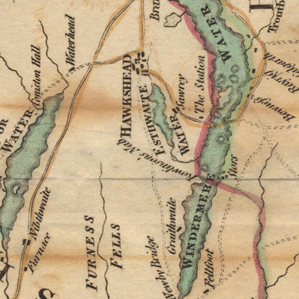 Ws02SD39.jpg 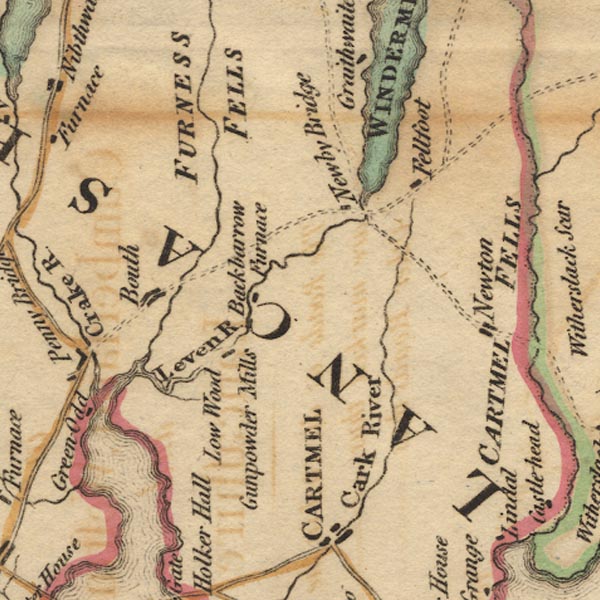 Ws02SD38.jpg "FURNESS FELLS" item:- Armitt Library : A1221.1 Image © see bottom of page |
|
|
|
||
| evidence:- | old text:- Camden 1789 placename:- Forness Fels |
|
| source data:- | Book, Britannia, or A Chorographical Description of the Flourishing Kingdoms of England,
Scotland, and Ireland, by William Camden, 1586, translated from the 1607 Latin edition
by Richard Gough, published London, 1789. goto source Page 131:- "... This whole tract [Furness], except on the coast, rises in high hills and vast piles of rocks called Forness fels, among which the Britans found a secure retreat, trusting to these natural fortresses, though nothing was inaccessible to the victorious Saxons. For we find the Britans settled here 228 years after the arrival of the Saxons, because at that time Egfrid, king of Northumberland, gave St. Cuthbert the land called Carthmell, and all the Britans in it, as is related in his life. ..." goto sourcePage 132:- "... If we read with some copies of Ptolemy SETANTIORUM |
|
|
|
||
| evidence:- | perhaps old text:- Green 1814 placename:- Furness Fell |
|
| source data:- | Set of prints, soft ground etchings, Sixty Small Prints, with
text, A Description of a Series of Sixty Small Prints, by
William Green, Ambleside, Westmorland, 1814. goto source page 8:- "... The hill above the Ferry House is called Furness Fell; ..." |
|
|
|
||
| evidence:- | old map:- Ford 1839 map placename:- Furness Fells |
|
| source data:- | Map, uncoloured engraving, Map of the Lake District of
Cumberland, Westmoreland and Lancashire, scale about 3.5 miles
to 1 inch, published by Charles Thurnam, Carlisle, and by R
Groombridge, 5 Paternoster Row, London, 3rd edn 1843.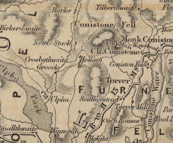 FD02SD29.jpg 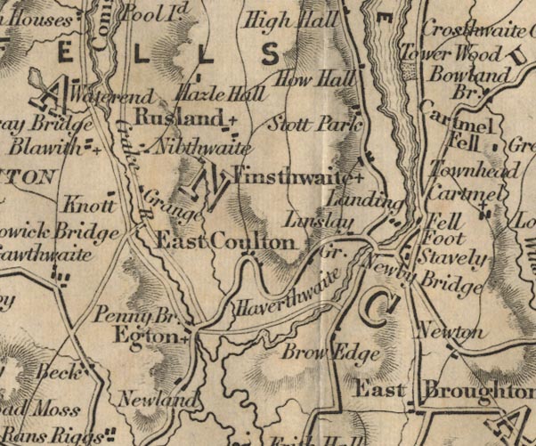 FD02SD38.jpg "FURNESS FELLS" Hill hachuring. item:- JandMN : 100.1 Image © see bottom of page |
|
|
|
||
| evidence:- | old map:- Garnett 1850s-60s H placename:- Furness Fells |
|
| source data:- | Map of the English Lakes, in Cumberland, Westmorland and
Lancashire, scale about 3.5 miles to 1 inch, published by John
Garnett, Windermere, Westmorland, 1850s-60s.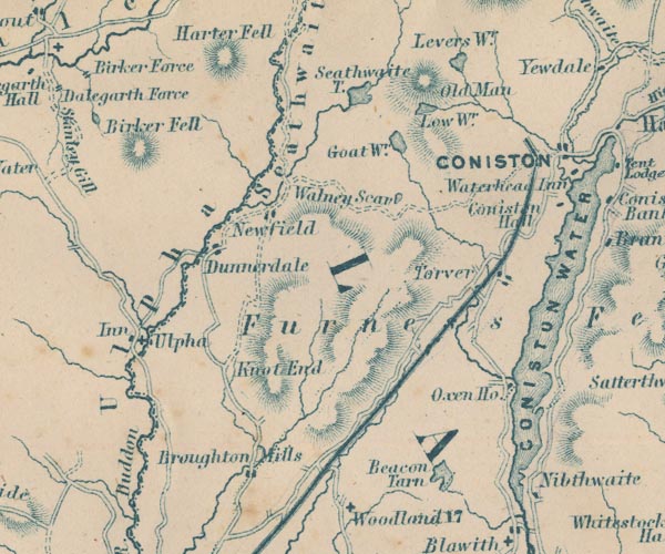 GAR2SD29.jpg "Furness Fells" area, hill hachuring 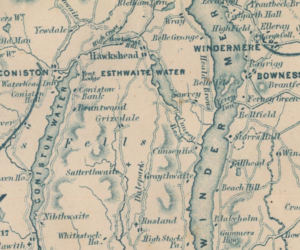 GAR2SD39.jpg item:- JandMN : 82.1 Image © see bottom of page |
|
|
|
||
| hearsay:- |
Shepherds in the Furness Fells fed sheep on tender sprouts of holly. Tracts of common
were covered with holly trees for this purpose. The mutton is said to have had an
attractive flavour. |
|
|
|
||
Lakes Guides menu.