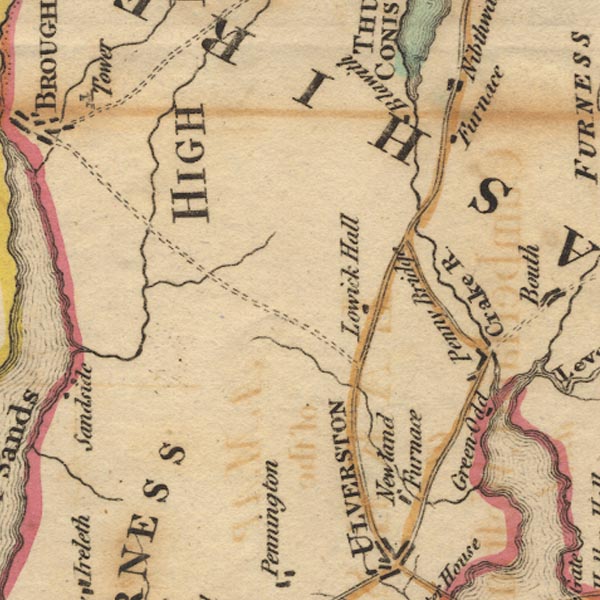
 West 1784 map SD28


|

|
|
|
gazetteer links places may or may not be labelled on the map |
||

|
-- Blawith |
|
|
|
-- Crake, River |
|
|
|
-- Greenodd |
|
|
|
-- Kirkby Pool |
|
|
|
-- Lowick Hall |
|
|
|
-- Newland Beck |
|
|
|
-- Newland Ironworks (?) |
|
|
|
-- Nibthwaite Ironworks (?) -- "Furnace" |
|
|
|
-- Penny Bridge |
|
|
|
-- Penny Bridge |
|
|
civil parishes The area roughly includes parts of parishes:- Blawith and Subberthwaite Kirkby Ireleth Mansriggs Osmotherley Pennington Colton Egton with Newland Dunnerdale-with-Seathwaite Millom Without Lowick Broughton West Angerton |
||
|
|
||
|
|
Lakes Guides menu. | |