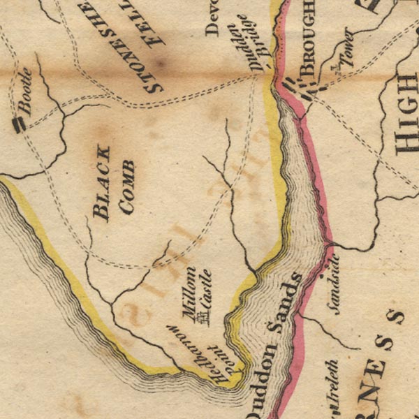
 West 1784 map SD18


|

|
|
|
gazetteer links places may or may not be labelled on the map |
||

|
-- Black Beck |
|
|
|
-- Black Combe -- "BLACK COMB" |
|
|
|
-- Broughton in Furness -- "BROUGHTON" |
|
|
|
-- Broughton Tower -- "Tower" |
|
|
|
-- Duddon Bridge |
|
|
|
-- Duddon Estuary |
|
|
|
-- Duddon Sands |
|
|
|
-- Kirkby Pool |
|
|
|
-- Millom Castle |
|
|
|
-- Sand Side |
|
|
|
-- Whicham Beck |
|
|
civil parishes The area roughly includes parts of parishes:- Broughton West Millom Millom Without Ulpha Dunnerdale-with-Seathwaite Whicham Waberthwaite Bootle |
||
|
|
||
|
|
Lakes Guides menu. | |