 Old Cumbria Gazetteer
 |
 |
|
| Duddon Sands, Millom Without | ||
| Duddon Sands | ||
| site name:- | Duddon Estuary | |
| civil parish:- | Millom Without (formerly Cumberland) | |
| county:- | Cumbria | |
| locality type:- | foreshore | |
| coordinates:- | SD16607520 (etc) | |
| 1Km square:- | SD1675 | |
| 10Km square:- | SD17 | |
| civil parish:- | Askam and Ireleth (formerly Lancashire) | |
| county:- | Cumbria | |
| locality type:- | sands | |
| 10Km square:- | SD17 | |
|
|
||
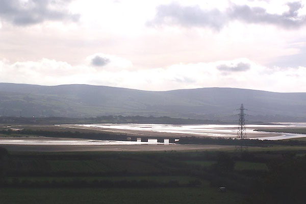 BMS51.jpg (taken 30.9.2006) |
||
|
|
||
| evidence:- | old map:- OS County Series (Lan 10 12) placename:- Duddon Sands |
|
| source data:- | Maps, County Series maps of Great Britain, scales 6 and 25
inches to 1 mile, published by the Ordnance Survey, Southampton,
Hampshire, from about 1863 to 1948. |
|
|
|
||
| evidence:- | old map:- Speed 1611 (Cmd) |
|
| source data:- | Map, hand coloured engraving, Cumberland and the Ancient Citie
Carlile Described, scale about 4 miles to 1 inch, by John Speed,
1610, published by J Sudbury and George Humble, Popes Head
Alley, London, 1611-12.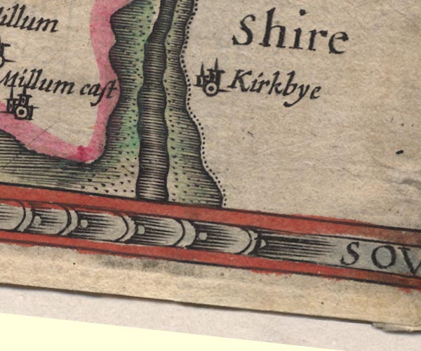 SP11SD27.jpg foreshore sands in Duddon Estuary item:- private collection : 16 Image © see bottom of page |
|
|
|
||
| evidence:- | poem:- Drayton 1612/1622 text placename:- Dudden Sands item:- placename, Duddon Sands |
|
| source data:- | Poem, Poly Olbion, by Michael Drayton, published by published by
John Marriott, John Grismand and Thomas Dewe, and others?
London, part 1 1612, part 2 1622. goto source goto sourcepage 136:- "... Dudden first, then Levin, lastly Ken, Of three bright Naiades nam'd, as Dudden on the West, That Cumberland cuts off from this Shire, doth invest Those Sands with her proud Style, ..." |
|
|
|
||
| evidence:- | old map:- Bowen and Kitchin 1760 |
|
| source data:- | Map, hand coloured engraving, A New Map of the Counties of
Cumberland and Westmoreland Divided into their Respective Wards,
scale about 4 miles to 1 inch, by Emanuel Bowen and Thomas
Kitchin et al, published by T Bowles, Robert Sayer, and John
Bowles, London, 1760.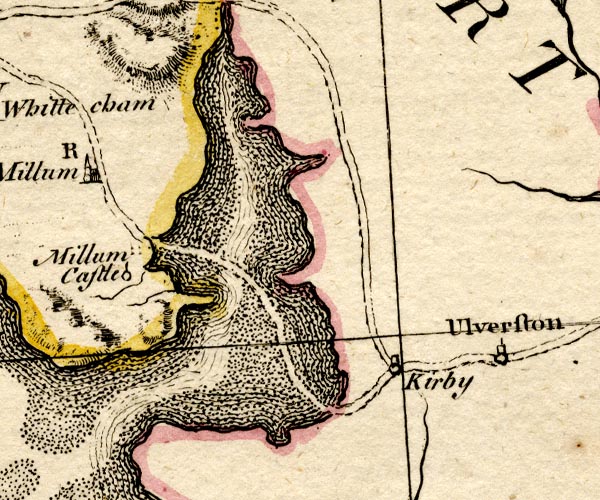 BO18SD17.jpg dotted area item:- Armitt Library : 2008.14.10 Image © see bottom of page |
|
|
|
||
| evidence:- | old text:- Mackenzie 1776 placename:- Duddon Sands |
|
| source data:- | Charts, and sailing directions, Nautical Descriptions of the
West Coast of Great Britain, Bristol Channel to Cape Wrath, by
Murdoch Mackenzie, published London, 1776. goto source Page 18:- "... ..." "The rocks and shoals to be avoided between Piel-of-Foudray and St. Bee's Head, are ... in the entry of Duddon Bay, with several patches of sand, near a league from the shore, that dry with spring-tide only: ... Selker" "..." "DUDDON Sands." "Only small vessels can get into safety in this Bay; for I was informed that there was not above seven or eight feet of water over most of the banks at high-water with spring-tide: with neap-tide, therefore, there is not two or three feet on them at high-water." |
|
|
|
||
| evidence:- | descriptive text:- West 1778 (11th edn 1821) placename:- Duddon Sands |
|
| source data:- | Guide book, A Guide to the Lakes, by Thomas West, published by
William Pennington, Kendal, Cumbria once Westmorland, and in
London, 1778 to 1821. goto source Mrs Radcliffe's Ride over Skiddaw, 1794 Page 308:- "[on Skiddaw] ... to the west, Duddon Sands gleamed in a long line among the fells of High Furness.- ..." |
|
|
|
||
| evidence:- | old map:- West 1784 map placename:- Duddon Sands |
|
| source data:- | Map, hand coloured engraving, A Map of the Lakes in Cumberland,
Westmorland and Lancashire, scale about 3.5 miles to 1 inch,
engraved by Paas, 53 Holborn, London, about 1784.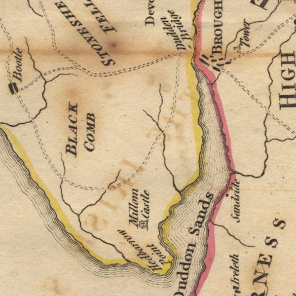 Ws02SD18.jpg 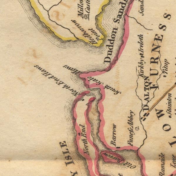 Ws02SD17.jpg item:- Armitt Library : A1221.1 Image © see bottom of page |
|
|
|
||
| evidence:- | old text:- Camden 1789 placename:- Duddensand |
|
| source data:- | Book, Britannia, or A Chorographical Description of the Flourishing Kingdoms of England,
Scotland, and Ireland, by William Camden, 1586, translated from the 1607 Latin edition
by Richard Gough, published London, 1789. goto source Page 131:- "... Forness ... the shore here running out a great way to the west, the sea, as if enraged at it, lashes it more furiously, and, in high tides. has even devoured the shore, and made three large bays, viz. Kentsand, into which the river Ken empties itself, Levensand and Duddensand, between which the land projects ..." |
|
|
|
||
| evidence:- | old map:- Laurie and Whittle 1806 placename:- Dudden Sands |
|
| source data:- | Road map, Completion of the Roads to the Lakes, scale about 10
miles to 1 inch, by Nathaniel Coltman? 1806, published by Robert
H Laurie, 53 Fleet Street, London, 1834. click to enlarge click to enlargeLw18.jpg "Dudden Sands" sands in estuary item:- private collection : 18.18 Image © see bottom of page |
|
|
|
||
| evidence:- | old map:- Garnett 1850s-60s H placename:- Duddon Sands |
|
| source data:- | Map of the English Lakes, in Cumberland, Westmorland and
Lancashire, scale about 3.5 miles to 1 inch, published by John
Garnett, Windermere, Westmorland, 1850s-60s.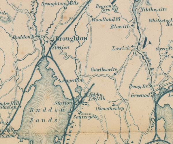 GAR2SD28.jpg "Duddon Sands" area in Duddon Estuary item:- JandMN : 82.1 Image © see bottom of page |
|
|
|
||
| evidence:- | old text:- Martineau 1855 |
|
| source data:- | Guide book, A Complete Guide to the English Lakes, by Harriet
Martineau, published by John Garnett, Windermere, Westmorland,
and by Whittaker and Co, London, 1855; published 1855-76. goto source Page 107:- "... When it is high water, the scene is fine: but the vast reaches of sand at low water are dreary. ..." |
|
|
|
||
| evidence:- | old print:- Goodwin 1887 (edn 1890) placename:- Duddon Sands |
|
| source data:- | Print, etching? Duddon Sands, Cumberland, by Harry Goodwin, 1883, published by Swan
Sonnenschein and Co, Paternoster Square, London, 1890.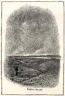 click to enlarge click to enlargePR1627.jpg Tipped in opposite p.268 of Through the Wordsworth Country, by William Knight. item:- JandMN : 382.57 Image © see bottom of page |
|
|
|
||
Lakes Guides menu.