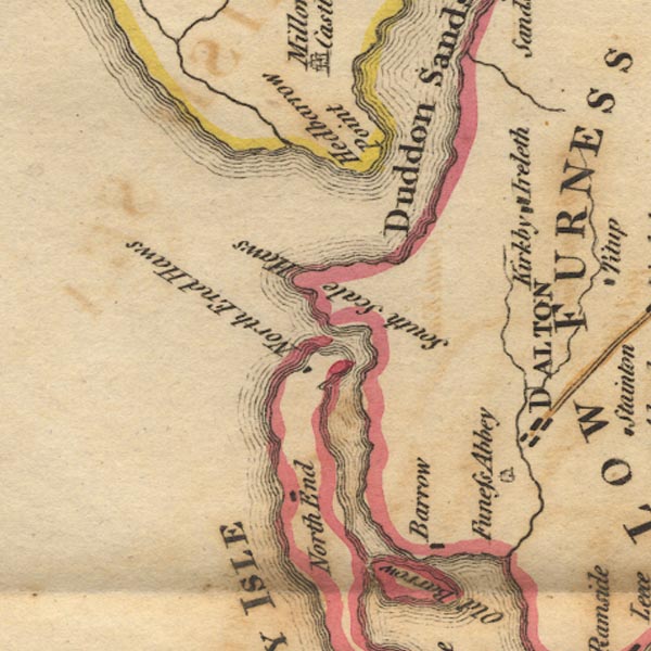
 West 1784 map SD17


|

|
|
|
gazetteer links places may or may not be labelled on the map |
||

|
-- Barrow-in-Furness |
|
|
|
-- Dalton-in-Furness -- "DALTON" |
|
|
|
-- Duddon Estuary |
|
|
|
-- Duddon Sands |
|
|
|
-- Furness Abbey -- "Funess Abbey" |
|
|
|
-- Haverigg Pool |
|
|
|
-- Hodbarrow Point |
|
|
|
-- Kirkby Ireleth |
|
|
|
-- North End Haws |
|
|
|
-- North Scale |
|
|
|
-- Poaka Beck |
|
|
|
-- Sandscale Haws |
|
|
|
-- Walney Island -- "WALNEY ISLE" |
|
|
civil parishes The area roughly includes parts of parishes:- Millom Without Barrow-in-Furness Millom Kirkby Ireleth Askam and Ireleth |
||
|
|
||
|
|
Lakes Guides menu. | |