 West 1784 map NY20


|

|
|
|
gazetteer links places may or may not be labelled on the map |
||

|
-- Brathay, River |
|
|
|
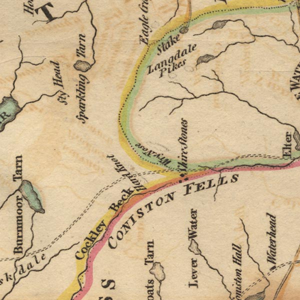
-- Coniston Fells -- "CONISTON FELLS" |
|
|
|
-- Duddon, River |
|
|
|
-- Easedale Tarn |
|
|
|
-- Great Langdale Beck |
|
|
|
-- Hardknott Pass |
|
|
|
-- Langdale Pikes |
|
|
|
-- Mite, River |
|
|
|
-- Sty Head |
|
|
|
-- Styhead Tarn |
|
|
|
-- Three Shire Stones |
|
|
|
-- Wrynose Pass |
|
|
civil parishes The area roughly includes parts of parishes:- Dunnerdale-with-Seathwaite Eskdale Lakes Ulpha Nether Wasdale Coniston St John's Castlerigg and Wythburn Borrowdale |
||
|
|
||
|
|
Lakes Guides menu. | |