 Saxton 1576 NY50


|

|
|
|
gazetteer links places may or may not be labelled on the map |
||

|
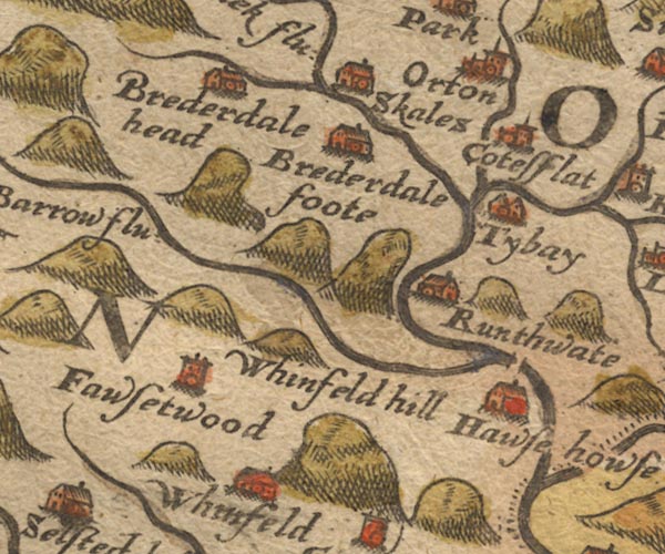
-- Birk Beck -- "Burhek flu:" |
|
|
|
-- Borrow Beck -- "Barrow flu:" |
|
|
|
-- Bretherdale Beck |
|
|
|
-- Bretherdale Foot -- "Brederdale foote" |
|
|
|
-- Bretherdale Hall -- "Brederdale foote" |
|
|
|
-- Bretherdale Head -- "Brederdale head" |
|
|
|
-- Chapel Beck |
|
|
|
-- Coatflatt Hall -- "Cotesflat" |
|
|
|
-- Forest Hall -- "Fawsetwood" |
|
|
|
-- Hawse House (?) -- "Hawse howse" |
|
|
|
-- Low Borrow Bridge |
|
|
|
-- Low Scales -- "Skales" |
|
|
|
-- Lune, River -- "Lune flu:" |
|
|
|
-- Orton -- "Orton" |
|
|
|
-- Roundthwaite -- "Runthwate" |
|
|
|
-- Tebay -- "Tybay" |
|
|
|
-- Whinfell -- "Whinfeld" |
|
|
|
-- Whinfell Beacon -- "Whinfeld hill" |
|
|
civil parishes The area roughly includes parts of parishes:- Shap Rural Whinfell Orton S Tebay Fawcett Forest Longsleddale Grayrigg Strickland Roger Whitwell and Selside Crosby Ravensworth |
||
|
|
||
|
|
Lakes Guides menu. | |