 Saxton 1576 NY46


|

|
|
|
gazetteer links places may or may not be labelled on the map |
||

|
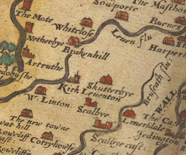
-- Brackenhill Tower -- "Brakenhill" |
|
|
|
-- Brunstock Beck -- "Bruscath flu:" |
|
|
|
-- Corryhouse (?) -- "Corryhowse" |
|
|
|
-- Kirklinton -- "Kirk Leventon" |
|
|
|
-- Laversdale -- "Limersdale" |
|
|
|
-- Lyne, River -- "Leven flu:" |
|
|
|
-- Scaleby -- "Scalbye" |
|
|
|
-- Scaleby Castle -- "Scalbye cast:" |
|
|
|
-- Skitby -- "Skutterbye" |
|
|
|
-- Westlinton -- "W: Linton" |
|
|
|
-- Whiteclose -- "Whitclose" |
|
|
civil parishes The area roughly includes parts of parishes:- Irthington Westlinton Arthuret Stanwix Rural Brampton Scaleby Walton Stapleton Kirklinton Middle Hethersgill |
||
|
|
||
|
|
Lakes Guides menu. | |