Old Cumbria Gazetteer
 |
 |
|
||
| Lyne, River | ||||
| runs into:- |  Esk, River Esk, River |
|||
|
|
||||
| civil parish:- | Arthuret (formerly Cumberland) | |||
| civil parish:- | Solport (formerly Cumberland) | |||
| civil parish:- | Stapleton (formerly Cumberland) | |||
| civil parish:- | Westlinton (formerly Cumberland) | |||
| county:- | Cumbria | |||
| locality type:- | river | |||
| locality type:- | boundary | |||
| locality type:- | parish boundary | |||
| 1Km square:- | NY3765 (etc) | |||
| 10Km square:- | NY36 | |||
|
|
||||
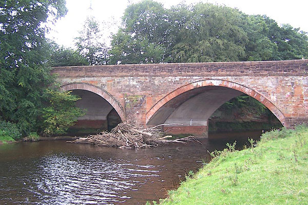
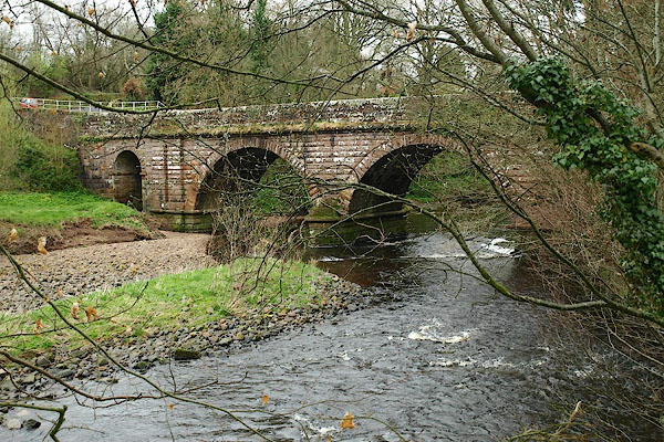
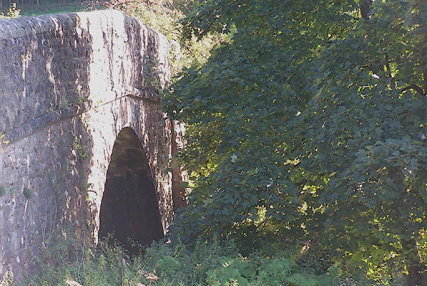
 BQJ93.jpg At Rack Bridge. (taken 11.4.2009) 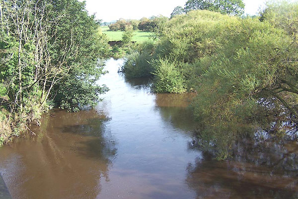 BMP96.jpg From Westlinton Bridge. (taken 15.9.2006) |
||||
|
|
||||
| evidence:- | old map:- OS County Series (Cmd 7 15) placename:- Line, River |
|||
| source data:- | Maps, County Series maps of Great Britain, scales 6 and 25
inches to 1 mile, published by the Ordnance Survey, Southampton,
Hampshire, from about 1863 to 1948. OS County Series (Cmd 10 12) OS County Series (Cmd 10 15) OS County Series (Cmd 11 1) |
|||
|
|
||||
| evidence:- | old map:- Saxton 1579 placename:- Leven Flu. |
|||
| source data:- | Map, hand coloured engraving, Westmorlandiae et Cumberlandiae Comitatus ie Westmorland
and Cumberland, scale about 5 miles to 1 inch, by Christopher Saxton, London, engraved
by Augustinus Ryther, 1576, published 1579-1645.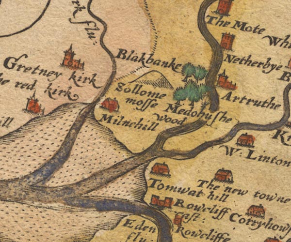 Sax9NY36.jpg 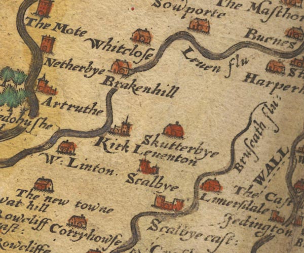 Sax9NY46.jpg "Leven flu:" item:- private collection : 2 Image © see bottom of page |
|||
|
|
||||
| evidence:- | old map:- Burghley 1590 (facsimile) placename:- Leven flu. |
|||
| source data:- | Facsimile map, A Platt of the Opposete Border of Scotland to ye West Marches of England,
parts of Cumberland and Scotland including the Debateable Land, from a manuscript
drawn for William Cecil, Lord Burghley, about 1590, published by R B Armstrong, 1897. courtesy of the National Library of Scotland 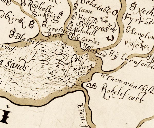 M048NY36.jpg "Leven flu" river item:- National Library of Scotland : MS6113 f.267 Image © National Library of Scotland |
|||
|
|
||||
| evidence:- | old map:- Mercator 1595 (edn?) placename:- Line, River |
|||
| source data:- | Map, hand coloured engraving, Northumbria, Cumberlandia, et
Dunelmensis Episcopatus, ie Northumberland, Cumberland and
Durham etc, scale about 6.5 miles to 1 inch, by Gerard Mercator,
Duisberg, Germany, about 1595. MER8CumA.jpg "" double line with stream lines; river, running into the Solway item:- JandMN : 169 Image © see bottom of page |
|||
|
|
||||
| evidence:- | old map:- Speed 1611 (Cmd) placename:- Leven flud |
|||
| source data:- | Map, hand coloured engraving, Cumberland and the Ancient Citie
Carlile Described, scale about 4 miles to 1 inch, by John Speed,
1610, published by J Sudbury and George Humble, Popes Head
Alley, London, 1611-12.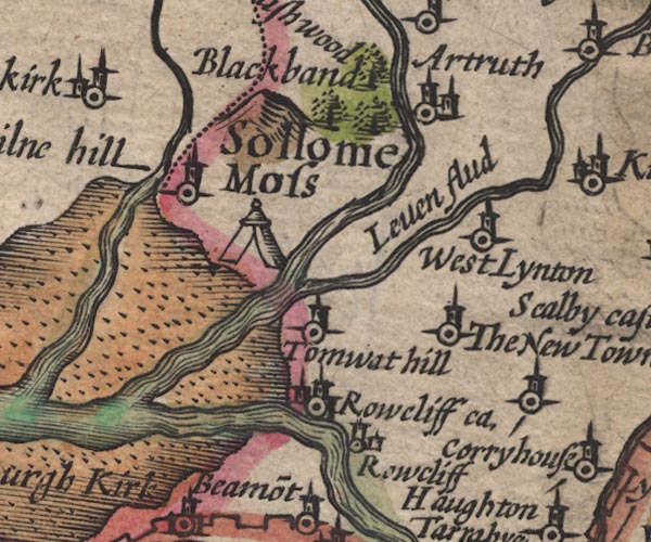 SP11NY36.jpg "Leven flud" double line with stream lines, runs into the Esk item:- private collection : 16 Image © see bottom of page |
|||
|
|
||||
| evidence:- | poem:- Drayton 1612/1622 text placename:- Leven |
|||
| source data:- | Poem, Poly Olbion, by Michael Drayton, published by published by
John Marriott, John Grismand and Thomas Dewe, and others?
London, part 1 1612, part 2 1622. goto source page 168:- "... All her attending Floods, faire Eden doe entreat, To lead them downe to Sea, when Leven comes along, And by her double Spring, being mightie them among, There overtaketh Eske, from Scotland that doth hye, ..." |
|||
|
|
||||
| evidence:- | old map:- Jansson 1646 placename:- Leven Flud |
|||
| source data:- | Map, hand coloured engraving, Cumbria and Westmoria, ie
Cumberland and Westmorland, scale about 3.5 miles to 1 inch, by
John Jansson, Amsterdam, Netherlands, 1646.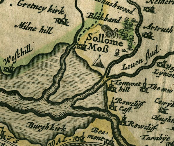 JAN3NY36.jpg "Leven flud" Double wiggly line, tapering to single. item:- JandMN : 88 Image © see bottom of page |
|||
|
|
||||
| evidence:- | old map:- Ogilby 1675 (plate 62) placename:- Leven Fluvius placename:- Line Fluvius |
|||
| source data:- | Raod strip map, uncoloured engraving, the Road from Carlisle to
Barwick, scale about 1 inch to 1 mile, by John Ogilby, London,
1675.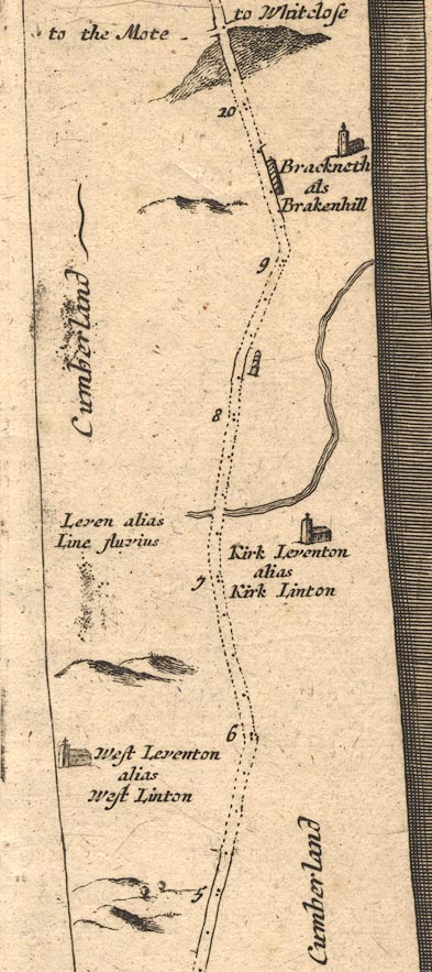 OG62m005.jpg In mile 7, Cumberland. "Leven alias Line fluvius" river crossed by the road, no bridge is drawn; the river is alongside the right of the road for 1.5 miles. item:- JandMN : 83 Image © see bottom of page |
|||
|
|
||||
| evidence:- | old map:- Sanson 1679 placename:- Leven fl. |
|||
| source data:- | Map, hand coloured engraving, Ancien Royaume de Northumberland
aujourdhuy Provinces de Nort, ie the Ancient Kingdom of
Northumberland or the Northern Provinces, scale about 9.5 miles
to 1 inch, by Nicholas Sanson, Paris, France, 1679. click to enlarge click to enlargeSAN2Cm.jpg "Leven fl." tapering wiggly line; river item:- Dove Cottage : 2007.38.15 Image © see bottom of page |
|||
|
|
||||
| evidence:- | old map:- Seller 1694 (Cmd) placename:- Lenen flud |
|||
| source data:- | Map, uncoloured engraving, Cumberland, scale about 12 miles to 1
inch, by John Seller, 1694. click to enlarge click to enlargeSEL9.jpg "Lenen flud" tapering wiggly line; river item:- Dove Cottage : 2007.38.89 Image © see bottom of page |
|||
|
|
||||
| evidence:- | old map:- Morden 1695 (Cmd) placename:- Leven River |
|||
| source data:- | Map, uncoloured engraving, Cumberland, scale about 4 miles to 1
inch, by Robert Morden, 1695, published by Abel Swale, the
Unicorn, St Paul's Churchyard, Awnsham, and John Churchill, the
Black Swan, Paternoster Row, London, 1695-1715.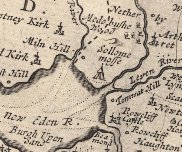 MD12NY36.jpg "Leven River" Running into the sea. item:- JandMN : 90 Image © see bottom of page |
|||
|
|
||||
| evidence:- | old map:- Bowen 1720 (plate 161) placename:- Line Fluvius |
|||
| source data:- | Road strip map, uncoloured engraving, pl.161, part of The Road
from Carlisle to Barwick, scale about 2 miles to 1 inch, with
sections in Cumberland, and Scotland, published by Emanuel
Bowen, St Katherines, London, 1720.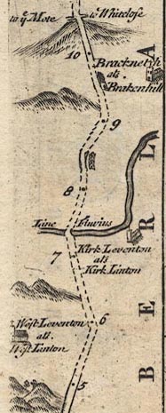 B161m05.jpg "Line Fluvius" item:- JandMN : 65.161 Image © see bottom of page |
|||
|
|
||||
| evidence:- | old map:- Badeslade 1742 placename:- Leven River |
|||
| source data:- | Map, uncoloured engraving, A Map of Cumberland North from
London, scale about 11 miles to 1 inch, with descriptive text,
by Thomas Badeslade, London, engraved and published by William
Henry Toms, Union Court, Holborn, London, 1742. click to enlarge click to enlargeBD10.jpg "Leven R" tapering wiggly line item:- JandMN : 115 Image © see bottom of page |
|||
|
|
||||
| evidence:- | old map:- Bowen and Kitchin 1760 placename:- Leven River placename:- Line River |
|||
| source data:- | Map, hand coloured engraving, A New Map of the Counties of
Cumberland and Westmoreland Divided into their Respective Wards,
scale about 4 miles to 1 inch, by Emanuel Bowen and Thomas
Kitchin et al, published by T Bowles, Robert Sayer, and John
Bowles, London, 1760.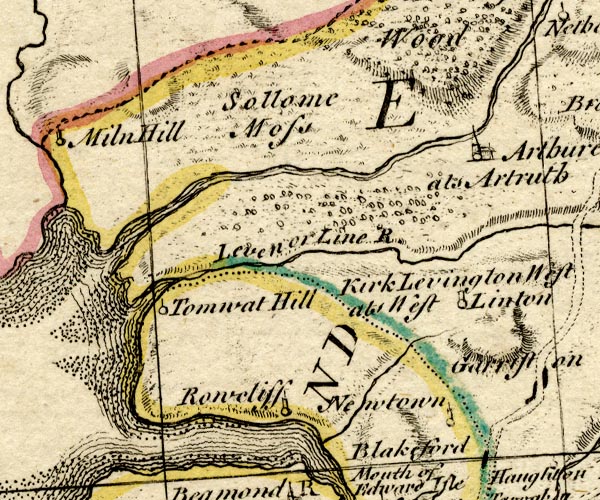 BO18NY36.jpg "Leven or Line R." wiggly line, and river mouth into the sea item:- Armitt Library : 2008.14.10 Image © see bottom of page |
|||
|
|
||||
| evidence:- | old map:- Donald 1774 (Cmd) |
|||
| source data:- | Map, 3x2 sheets, The County of Cumberland, scale about 1 inch to 1 mile, by Thomas
Donald, engraved and published by Joseph Hodskinson, 29 Arundel Street, Strand, London,
1774. |
|||
|
|
||||
| evidence:- | old map:- Donald 1774 (Cmd) placename:- Line River |
|||
| source data:- | Map, hand coloured engraving, 3x2 sheets, The County of Cumberland, scale about 1
inch to 1 mile, by Thomas Donald, engraved and published by Joseph Hodskinson, 29
Arundel Street, Strand, London, 1774. D4NY47SE.jpg "Line River" 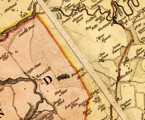 D4NY36SE.jpg single or double wiggly line; a river into the Esk item:- Carlisle Library : Map 2 Images © Carlisle Library |
|||
|
|
||||
| evidence:- | old map:- Donald 1774 (Cmd) |
|||
| source data:- | Map, 3x2 sheets, The County of Cumberland, scale about 1 inch to 1 mile, by Thomas
Donald, engraved and published by Joseph Hodskinson, 29 Arundel Street, Strand, London,
1774. |
|||
|
|
||||
| evidence:- | old map:- Donald 1774 (Cmd) placename:- Line River |
|||
| source data:- | Map, hand coloured engraving, 3x2 sheets, The County of Cumberland, scale about 1
inch to 1 mile, by Thomas Donald, engraved and published by Joseph Hodskinson, 29
Arundel Street, Strand, London, 1774. D4NY47SE.jpg "Line River" D4NY36SE.jpg single or double wiggly line; a river into the Esk item:- Carlisle Library : Map 2 Images © Carlisle Library |
|||
|
|
||||
| evidence:- | old text:- Camden 1789 placename:- Leven, River |
|||
| source data:- | Book, Britannia, or A Chorographical Description of the Flourishing Kingdoms of England,
Scotland, and Ireland, by William Camden, 1586, translated from the 1607 Latin edition
by Richard Gough, published London, 1789. goto source Page 176:- "..." "... The Leven and other river before-mentioned, rising in the very border of two kingdoms, ..." |
|||
|
|
||||
| evidence:- | old map:- Bailey 1797 placename:- Line River |
|||
| source data:- | Map, soil etc, uncoloured engraving, Cumberland, scale about 21
miles to 1 inch, by J Bailey, engraved by Neele, Strand,
published by Messrs Robinson, Paternoster Row and G Nicol, Pall
Mall, London, 1797.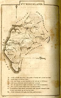 click to enlarge click to enlargeBY04.jpg "Line R." river item:- Armitt Library : A680.2 Image © see bottom of page |
|||
|
|
||||
| evidence:- | road book:- Cary 1798 (2nd edn 1802) placename:- Line, River |
|||
| source data:- | Road book, itineraries, Cary's New Itinerary, by John Cary, 181
Strand, London, 2nd edn 1802. goto source click to enlarge click to enlargeC38267.jpg page 267-268 "Cross the Line River." goto source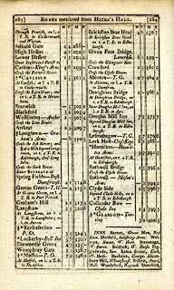 click to enlarge click to enlargeC38283.jpg page 283-284 "Cross the Line River." item:- JandMN : 228.1 Image © see bottom of page |
|||
|
|
||||
| evidence:- | old map:- Cooke 1802 placename:- Line River |
|||
| source data:- | Map, Cumberland, scale about 15.5 miles to 1 inch, by George
Cooke, 1802, bound in Gray's New Book of Roads, 1824, published
by Sherwood, Jones and Co, Paternoster Road, London, 1824. click to enlarge click to enlargeGRA1Cd.jpg "Line R." tapering wiggly line; river item:- Hampshire Museums : FA2000.62.2 Image © see bottom of page |
|||
|
|
||||
| evidence:- | old map:- Cooper 1808 placename:- Line River |
|||
| source data:- | Map, uncoloured engraving, Cumberland, scale about 10.5 miles to
1 inch, drawn and engraved by Cooper, published by R Phillips,
Bridge Street, Blackfriars, London, 1808. click to enlarge click to enlargeCOP3.jpg "Line R." tapering wiggly line; river item:- JandMN : 86 Image © see bottom of page |
|||
|
|
||||
| evidence:- | old map:- Wallis 1810 (Cmd) placename:- Line River |
|||
| source data:- | Road map, hand coloured engraving, Cumberland, scale about 16
miles to 1 inch, by James Wallis, 77 Berwick Stree, Soho,
London, 1810. click to enlarge click to enlargeWL13.jpg "Line R." river item:- Dove Cottage : 2009.81.10 Image © see bottom of page |
|||
|
|
||||
| evidence:- | old map:- Hall 1820 (Cmd) placename:- Line River |
|||
| source data:- | Map, hand coloured engraving, Cumberland, scale about 21 miles
to 1 inch, engraved by Sidney Hall, published by S Leigh, 18
Strand, London, 1820-31. click to enlarge click to enlargeHA14.jpg "Line R." tapering wiggly line; river; and perhaps the Black Lyne and White Lyne item:- JandMN : 91 Image © see bottom of page |
|||
|
|
||||
| evidence:- | old text:- Gents Mag placename:- Leven, River |
|||
| source data:- | Magazine, The Gentleman's Magazine or Monthly Intelligencer or
Historical Chronicle, published by Edward Cave under the
pseudonym Sylvanus Urban, and by other publishers, London,
monthly from 1731 to 1922. goto source Gentleman's Magazine 1828 part 2 p.420 Review of an article in Archaeologia vol.22 part 1:- "'Leven. - Upon this river also dwelleth many Grames, and above Kirklynton on Sompert dwelleth a great surname of Fosters, and about Hethersgill is a surname of Hetheringtons.' P.169." |
|||
|
|
||||
| evidence:- | old map:- Ford 1839 map placename:- Line River |
|||
| source data:- | Map, uncoloured engraving, Map of the Lake District of
Cumberland, Westmoreland and Lancashire, scale about 3.5 miles
to 1 inch, published by Charles Thurnam, Carlisle, and by R
Groombridge, 5 Paternoster Row, London, 3rd edn 1843.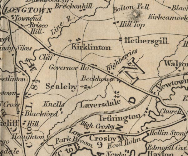 FD02NY46.jpg "Line R." item:- JandMN : 100.1 Image © see bottom of page |
|||
|
|
||||
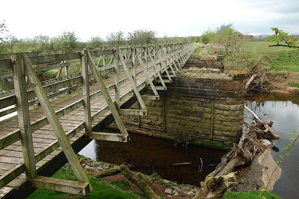
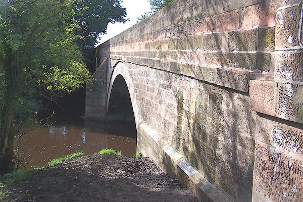
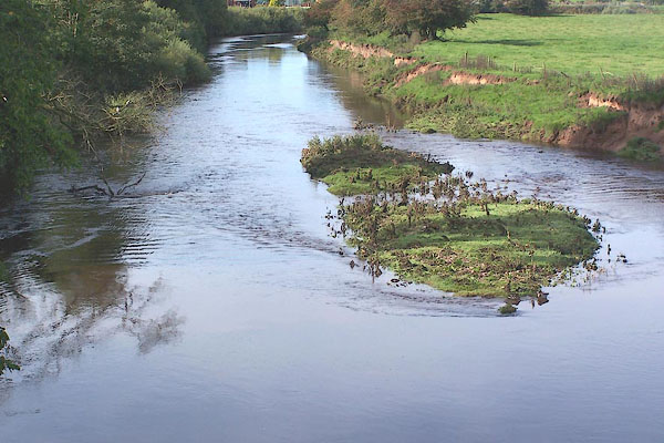 BMP97.jpg From Westlinton Bridge. (taken 15.9.2006) 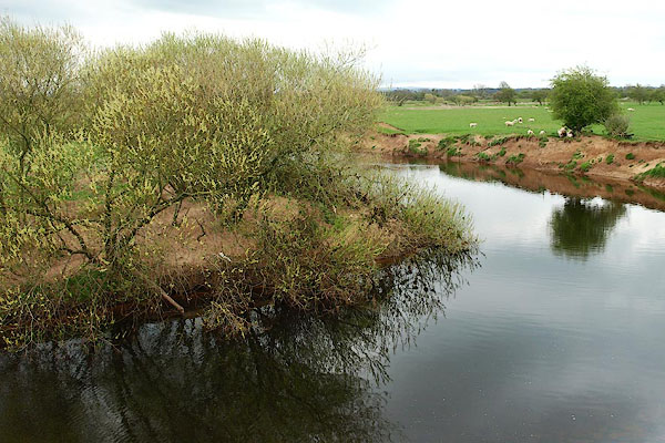 BQJ66.jpg From the railway bridge, Westlinton (taken 11.4.2009) 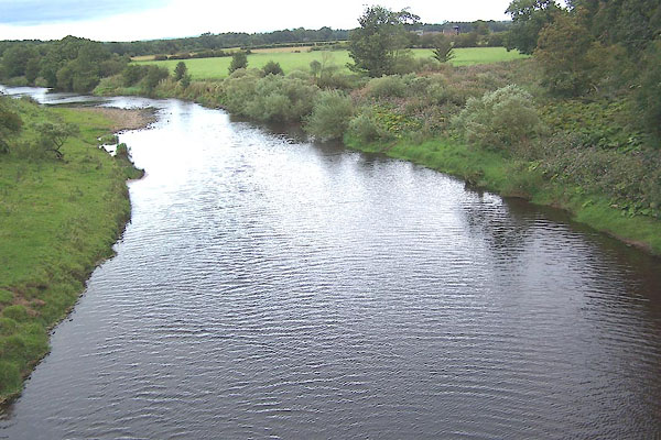 BOB32.jpg From Cliff Bridge. (taken 31.8.2007) 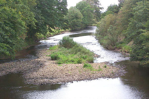 BOB33.jpg From Cliff Bridge. (taken 31.8.2007) |
||||
|
|
||||
| places:- |
|
|||
|
||||
|
||||
|
||||
|
||||
|
||||
|
||||
|
||||
|
||||
|
||||
|
||||
|
||||
|
||||
|
||||
|
||||
Lakes Guides menu.