 Saxton 1576 NY00


|

|
|
|
gazetteer links places may or may not be labelled on the map |
||

|
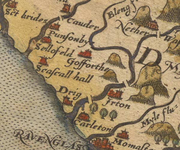
-- Bleng, River -- "Bleng flu:" |
|
|
|
-- Calder Bridge |
|
|
|
-- Calder Bridge -- "Cauder" |
|
|
|
-- Carleton Hall -- "Carleton" |
|
|
|
-- Drigg -- "Drig" |
|
|
|
-- Gosforth -- "Gosforthe" |
|
|
|
-- Holme Bridge |
|
|
|
-- Irt, River |
|
|
|
-- Irton -- "Irton" |
|
|
|
-- Mite, River -- "Myle flu:" |
|
|
|
-- Ponsonby -- "Punsonbye" |
|
|
|
-- Santon Bridge |
|
|
|
-- Seascale Hall -- "Scascall hall" |
|
|
|
-- Sellafield (?) -- "Sellofeld" |
|
|
civil parishes The area roughly includes parts of parishes:- Drigg and Carleton Irton with Santon Seascale Ponsonby Gosforth Haile St Bridget Beckermet Lowside Quarter Ennerdale and Kinniside Egremont St John Beckermet |
||
|
|
||
|
|
Lakes Guides menu. | |