 Morden 1695 (Cmd) NY56


|

|
|
|
gazetteer links places may or may not be labelled on the map |
||

|
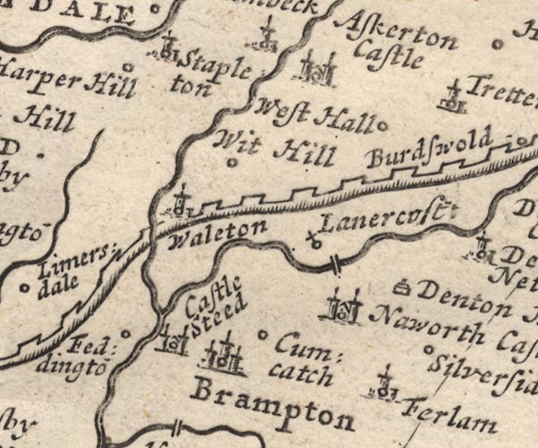
-- Askerton Castle -- "Askerton Castle" |
|
|
|
-- Brampton -- "Brampton" |
|
|
|
-- Castlesteads -- "Castle Steed" |
|
|
|
-- Cumcatch -- "Cumcatch" |
|
|
|
-- Denton Hall -- "Denton Hall" |
|
|
|
-- Farlam -- "Ferlam" |
|
|
|
-- Hadrian's Wall -- "The Picts Wall" |
|
|
|
-- Harperhill -- "Harper Hill" |
|
|
|
-- Irthing, River -- "Irthing R." -- "Trout Beck
R." |
|
|
|
-- Irthington -- "Fedingto~" |
|
|
|
-- Lanercost Bridge |
|
|
|
-- Lanercost Priory -- "Lanercost:" |
|
|
|
-- Naworth Castle (?) -- "Naworth Castle" |
|
|
|
-- Silver Side -- "Silverside" |
|
|
|
-- Stapleton -- "Stapleton" |
|
|
|
-- Walton -- "Waleton" |
|
|
|
-- West Hall -- "West Hall" |
|
|
|
-- White Hill -- "Wit Hill" |
|
|
civil parishes The area roughly includes parts of parishes:- Stapleton Askerton Hethersgill Walton Irthington Waterhead Kingwater Brampton Burtholme Nether Denton Farlam |
||
|
|
||
|
|
Lakes Guides menu. | |