 Sedgwick 1822-35

|

|
|
|
item:- Sedgwick Archive : map 54 image:- © see bottom of page |
click to enlarge |
|
|
courtesy of the Sedgwick Archive
|
||
|
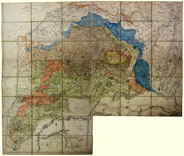
Geological map, The County of Cumberland, scale about 2
miles to 1 inch, surveyed by Thomas Donald, 1770-71,
published William Faden, Charing Cross, 2nd edn 1802;
geologically coloured by Adam Sedgwick, perhaps from about
1823?
There is a comment in Adam Sedgwick's field notebook no.12 p.88, 28 August 1823 - 'Miserable rain. Colour maps pour passer le temps' This may or may not refer to this map. |
||

|
Sedgwick 1822-35 | |
| inscription:- |
printed bottom
2nd Edition Published by W. Faden Charing Cross Jany. [5] 180[2] |
|
| inscription:- |
signature: ms upper left
A. Sedgwick |
|
| wxh, sheet:- | 64x84cm (about) | |
| scale:- | 1 to 130000 ? (estimate) | |