 Philip 1920s

|

|
|
|
item:- JandMN (133) image:- © see bottom of page |
click to enlarge |
|
|
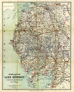
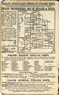
Map, colour lithograph? Philips' Cyclists' Map of the
Lake District, scale about 4 miles to 1 inch, by George
Philip and Son, 32 Fleet Street, London, and Liverpool,
Merseyside, 1920s?
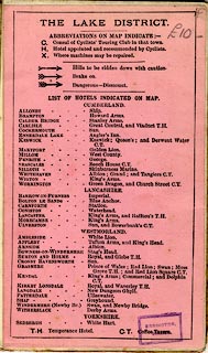
The map is overprinted with graded red arrows to mark hills to beware of, and letters indicating Cyclists' Touring Club consuls, recommeded hotels, and bicycle repair facilities. |
||

|
Philip 1920s | |
| map feature:- | mounted (linen) & folded (4x3) & card cover & up is N & scale line & lat and long scales & table of symbols & sea tinted & coast line & rivers & lakes & relief & hill hachuring & parks & county & settlements & roads & railways & canals | |
| inscription:- |
printed title, lower left
PHILIP'S NEW MAP / OF THE / LAKE DISTRICT / OF / CUMBERLAND, WESTMORLAND / AND / LANCASHIRE |
|
| inscription:- |
printed bottom
GEORGE PHILIP & SON, LONDON & LIVERPOOL |
|
| inscription:- |
printed above scale line
English Miles |
|
| scale line:- | 10 miles = 61.5 mm | |
| scale:- | 1 to 260000 ? (1 to 261680 from scale line) | |
| wxh, cover:- | 10x16cm | |
| wxh, folded:- | 9.5x15.5cm | |
| wxh, sheet:- | 37x45.5cm | |
| wxh, map:- | 331x424mm | |

|
||
|
||
|
||
|
|
notes | |