 Richards 1700-99

|

|
|
|
item:- Carlisle Library : Map 340 image:- © Carlisle Library |
click to enlarge | |
| Illustration of part of map only. | ||
|
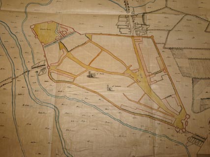
Town plan, copy, manuscript ink and wash colour on
tracing paper, Carlile, scale about 32 inches to 1 mile, by
James Richards; the original drawn for Lord Dartmouth,
Master of the Ordnance, 1684-85.
There is a vignette, A Prospect of Carlile towards the North. |
||
| map type:- | Richards 1700-99 | |
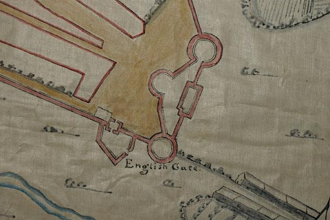
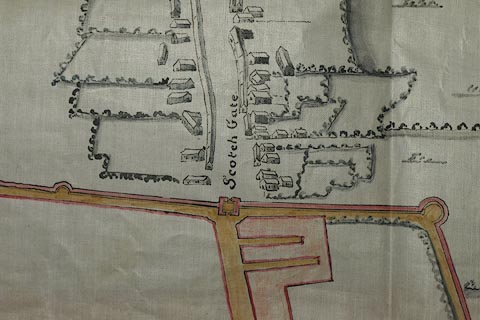
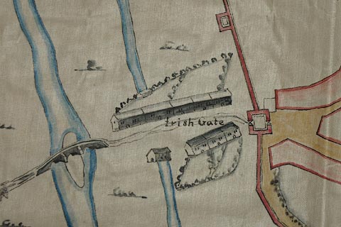
| inscription:- |
ms upper left
CARLILE. |
|
| inscription:- |
ms in vignette
A Prospect of Carlile towards the North - Iac : Richards fecit |
|
| inscription:- |
ms with scale line
A Scale of yards for ye whole Mapp. |
|
| scale line:- | 200 yards = 93.0 mm | |
| wxh, sheet:- | 95x87cm | |
| wxh, map:- | 906x801mm | |
| scale:- | 1 to 2000 ? (1 to 1967 from scale line, assuming a statute mile) | |
|
images:- © Carlisle Library |
|
|
|
||
|
||

|
notes | |