
JandMN (338)
image:-
© see bottom of page

click to enlarge
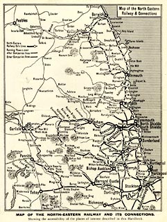
Shows railways in Scotland, Northumberland, Durham, and parts of North Yorkshire, Cumberland and Westmorland.Those in Cumbria belonging to the NER are - Newcastle and Carlisle Railway and Alston branch, South Durham and Lancashire Union Railway, and Eden Vallet Railway. NER running powers over the Cockermouth, Keswick and Penrith Railway are indicated.
From a guide book.

Map of the North Eastern / Railway & Connections
MAP OF THE NORTH-EASTERN RAILWAY AND ITS CONNECTIONS. / Showing the accessibiility of the places described in this Handbook.
 North Eastern Railway 1900s