 Senex 1719-57

|

|
|
|
item:- JandMN (308) image:- © see bottom of page |
click to enlarge |
|
|
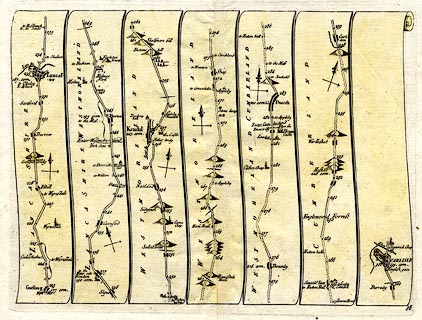
Strip map, road map, plate 38, the road from south of
Lancaster through Westmorland to Carlisle, Cumberland, scale
about 2.5 miles to 1 inch, by John Senex, at The Globe,
Salisbury-Court, Fleetstreet, London, 1719.
Included in An Actual Survey of all the Principal Roads of England and Wales. plate 38 - from south of Lancaster, through Carnforth, Lancashire; then Burton, Kendal, Shap, Westmorland; Penrith to Carlisle, Cumberland. |
||

|
Senex 1719-57 | |
| inscription:- |
printed bottom right
38 |
|
| wxh, sheet:- | 23x19cm | |
| wxh, map:- | 21x15.5cm | |