 OS 1918 Popular Edition

|

|
||
|
item:- JandMN (203) image:- © see bottom of page |
click to enlarge |
||

|
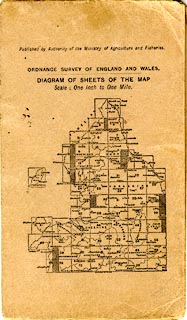
index to OS 1918 sheets | ||
|
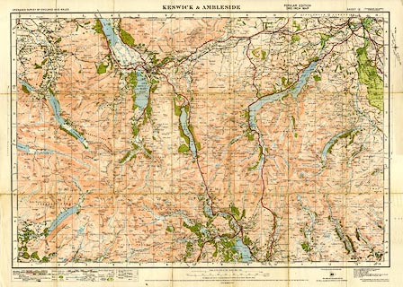
Map, colour printed, Keswick and Ambleside, scale 1 inch
to 1 mile, Popular Edition sheet 12, published by the
Ordnance Survey, Southampton, Hampshire, 1919-26, revised to
1921, printed 1929.
Parts of Cumberland, Lancashire, and Westmorland. |
|||
|
|
OS 1918 Popular Edition | ||
| map feature:- | mounted & folded (7x3) & card cover & location map (cover) & index map (back cover) & table of symbols & north point & magnetic deviation & up is N & scale line & lat and long scales & index grid & rivers & lakes & relief & contours & spot heights & woods & forests & parks & county & settlements & roads & railways & canals | ||
| inscription:- |
printed top
ORDNANCE SURVEY OF ENGLAND AND WALES / KESWICK & AMBLESIDE / POPULAR EDITION ONE-INCH MAP / SHEET 12 (Cumberland, Lancashire & Westmorland) |
||
| inscription:- |
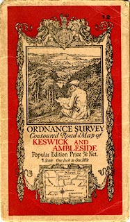
printed cover
12 / ORDNANCE SURVEY / Contoured Road Map of / KESWICK AND / AMBLESIDE / Popular Edition Price 2/6 Net. / Scale One Inch to One Mile. black and red on pale brown; Ellis Martin design; picture of a walker on a hillside |
||
| wxh, folded:- | 11.5x19cm | ||
| wxh, sheet:- | 76x56cm | ||
| scale:- | 1 to 63360 ? (nominal) | ||

|
|||
|
|||
|
|||
|
|
notes | ||