 OS 1918 Popular Edition

|

|
|

|
back to object record | |
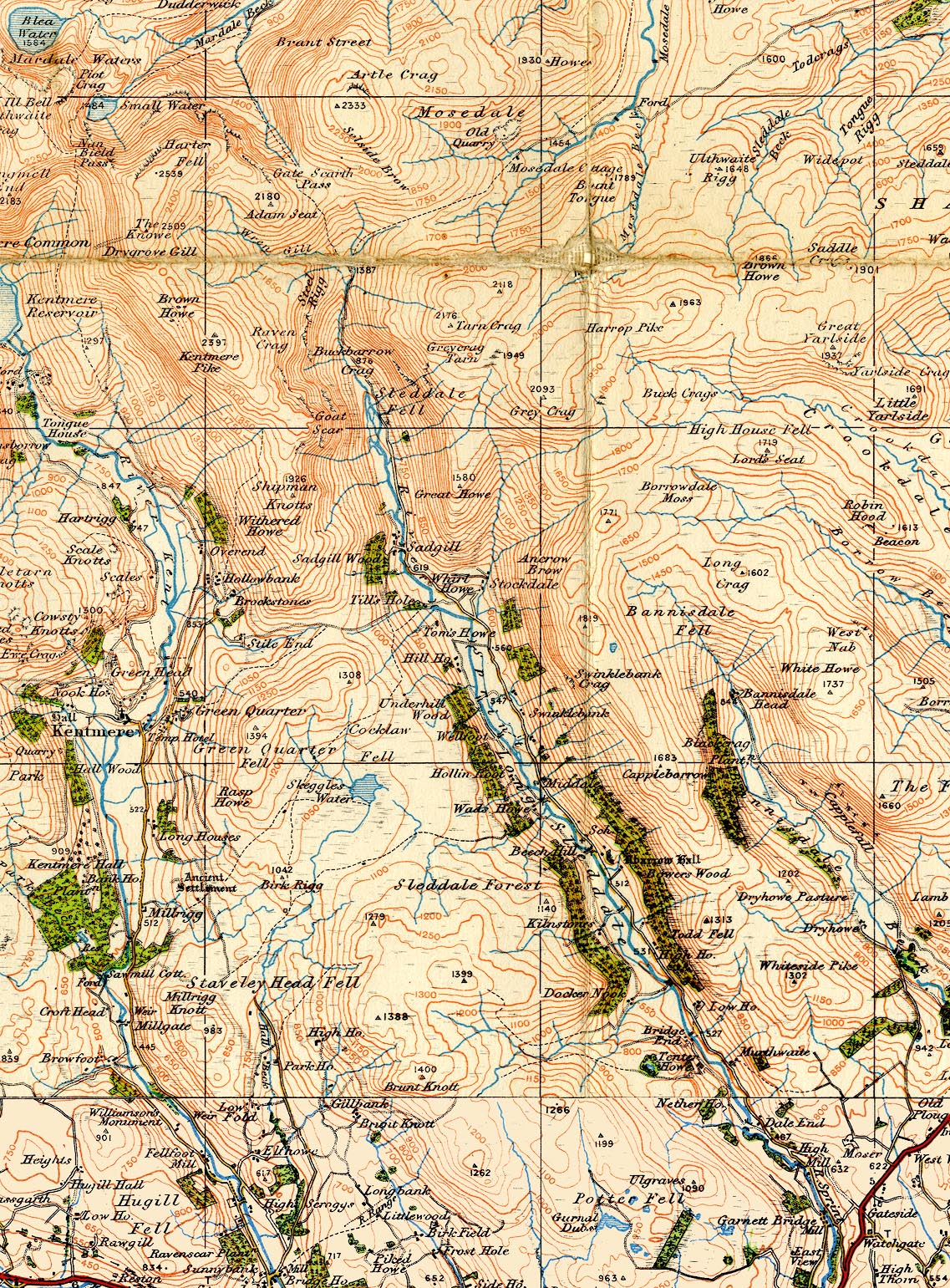
| OS 1918-29, Longsleddale | ||
|
Notes about Longsleddale from the One Inch Popular edition
maps of Great Britain, sheet 12 - Keswick and Ambleside,
scale 1 inch to 1 mile, published by the Ordnance Survey,
Southampton, Hampshire, from about 1918 to 1929, between the
4th and 5th editions.
|
||
|
||
| Map Features | ||
|
|
||
| scale |
The map scale is about:-
1 to 63360 ? (nominal) 1 mile to 1 inch |
|
|
Places identified:-
|
||
|
A dot and triangle are marked on several hill tops. This
symbol usually means a 'triangulation pillar' but such do
not exist at all the hills marked in this area.
|
||
Lakes Guides menu.