button to main menu Stanford 1880

item:-
JandMN (151_1)
image:-
©  see bottom of page
image, button to large image
click to enlarge


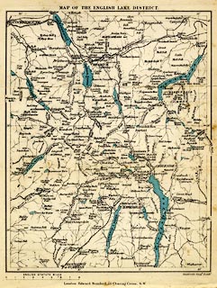
Map, colour printed, Map of the English Lake District, scale about 4 miles to 1 inch, by Edward Stanford, Stanford's Geographical Establishment, 55 Charing Cross, London, 1880?.
Folded and tipped in as frontispiece to the Tourist's Guide to the English Lake District, by Henry Irwin Jenkinson.
   Stanford 1880
map feature:- up is N & scale line & lat and long scales & lat and long grid & rivers & lakes & county & settlements & roads & railways
inscription:- printed top
MAP OF THE ENGLISH LAKE DISTRICT
inscription:- printed above scale line
ENGLISH STATUTE MILES
scale line:- 8 miles = 51.1 mm
scale:- 1 to 250000 ? (1 to 251952 from scale line)
wxh, sheet:- 16.5x21.5cm
wxh, map:- 145x188mm