 Camden 1607 map

|

|
|
|
item:- private collection (60) image:- © see bottom of page |
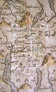
click to enlarge |
|
|
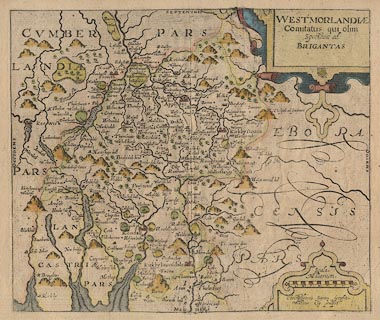
Map, hand coloured engraving, Westmorlandiae Comitatus,
ie the County of Westmorland, scale about 3.5 miles to 1
inch, by Christopher Saxton, 1576, engraved by William Kip,
London, 1607; published by George Bishop and John Norton,
London, 1610.
The map comes from the first English translation of Britannia by William Camden, translated by Philemon Holland, 1610. The plate has no text on the reverse, and no plate number. There is a watermark in the paper. The plate seems to have scuff marks which show as lines in the printing. The original fold still shows a little in the map; colours are faded. |
||

|
Camden 1607 map | |
| map feature:- | swash lettering & strapwork cartouche & labelled borders & scale line & sea stippled & coast shaded & rivers & bridges & lakes & relief & hillocks & woods & parks & county & settlements | |
| inscription:- |
printed title cartouche, upper right
WESTMORLANDIAE / Comitatus qui olim / Spectauit ad / BRIGANTES |
|
| inscription:- |
printed with scale line, lower right
Scala / Miliarium. / Christophorus Saxton scripsit / William Kip sculpsit |
|
| scale line:- | 8 miles = 55.4 mm | |
| scale:- | 1 to 230000 ? (1 to 232396 from scale line wrongly assuming a statute mile) | |
| wxh, sheet:- | 36x31cm | |
| wxh, plate:- | 313x262mm | |
| wxh, map:- | 309x262mm | |
|
||
|
|
notes | |