button to main menu Black 1850 map

item:-
Dove Cottage : 2007.38.75
image:-
©  see bottom of page
image, button to large image
click to enlarge


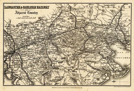
Map, uncoloured engraving, Lancaster and Carlisle Railway and Adjacent Country, through Lancashire, Westmorland and Cumberland, scale about 7.5 miles to 1 inch, by John Bartholomew, Edinburgh, published by Adam and Charles Black, 27 North Bridge, Edinburgh, Lothian, about 1850-52.
Tipped in after the index in Black's Picturesque Guide to the English Lakes, published by Adam and Charles Black, 6 North Bridge, Edinburgh, Lothian, 5th edn 1852.
   Black 1850 map
map feature:- north point & up is E & scale line & sea areas & sea plain & coast line & coast form lines & rivers & lakes & relief & hill hachuring & parks & county & settlements & roads & railways & canals
inscription:- printed upper left
LANCASTER & CARLISLE RAILWAY / AND / Adjacent Country
inscription:- printed bottom, centre and right
Published byAdam & Charles Black 27 North Bridge Edinburgh / Drawn & Engraved by J. Bartholomew Edinr.
inscription:- printed above scale line
British Miles
scale line:- 10 miles = 33.4 mm
scale:- 1 to 480000 ? (1 to 481840 from scale line)
wxh, sheet:- 24.5x18cm
wxh, map:- 229x149mm