item:- Dove Cottage : 2007.38.75
image:- © see bottom of page
 BC23.jpg
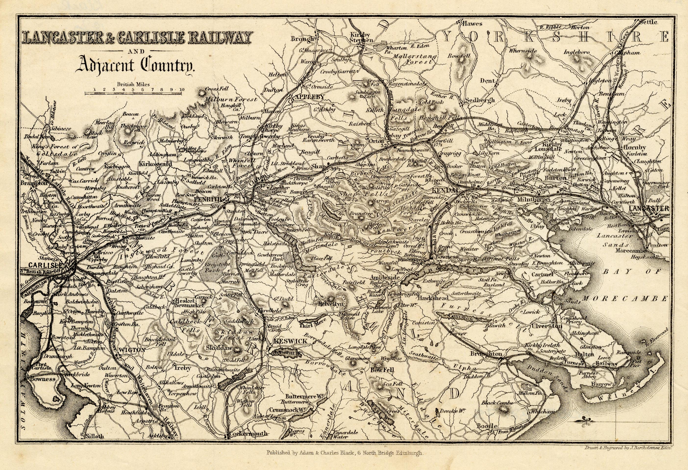
Map, uncoloured engraving, Lancaster and Carlisle Railway and
Adjacent Country, through Lancashire, Westmorland and
Cumberland, scale about 7.5 miles to 1 inch, by John
Bartholomew, Edinburgh, published by Adam and Charles Black, 27
North Bridge, Edinburgh, Lothian, about 1850-52.
 Lakes Guides menu.