 Pennant 1777

|

|
|
|
item:- private collection (66) image:- © see bottom of page |
click to enlarge |
|
|
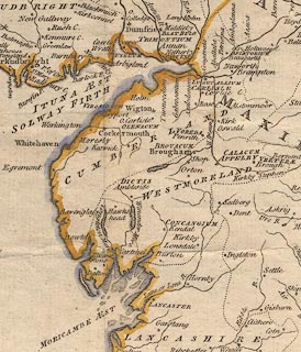
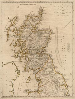
Map, hand coloured engraving, A Map of Scotland, Hebrides
and Part of England, drawn for Thomas Pennant, engraved by J
Bayly, published by Benjamin White, London, 1777.
|
||

|
Pennant 1777 | |
| map feature:- | up is N & lat and long scales (conical projection? longitude E and W of Edinburgh) & sea plain & coast shaded & rivers & lakes & relief & hillocks & county & settlements | |
| inscription:- |
printed upper right
A / MAP of SCOTLAND / the / HEBRIDES / and / PART of ENGLAND / adapted / to MR. PENNANT'S Tours |
|
| inscription:- |
printed bottom left and centre
J. Bayly sculp. / Published 1st. of May 1777 by Benj, White. |
|
| wxh, sheet:- | 47.5x63cm | |
| wxh, plate:- | 470x615mm (roughly) | |
| wxh, map:- | 456x598mm | |
|
||
|
|
notes | |