 Jenner 1643

|

|
|
|
item:- private collection (52_Cmd) image:- © see bottom of page |
click to enlarge |
|
|
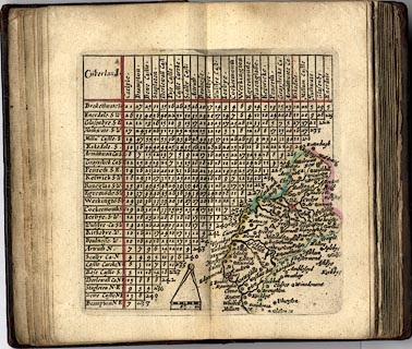
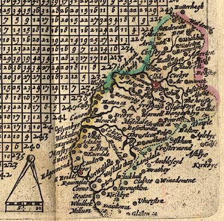
Table of distances, with map, hand coloured engraving,
Cumberland, scale about 21 miles to 1 inch, engraved by
Jacob van Langeren, published by Thomas Jenner, Cornhill,
London, 1643.
Published in A Direction for the English Travailler. The map is tucked into the triangular space at the bottom right of the table of distances. |
||

|
Jenner 1643 | |
| map feature:- | up is N & scale line & dividers & rivers & lakes & relief & hillocks & county & settlements & road distances (?) | |
| inscription:- |
printed plain cartouche, upper left
Cu~berland. |
|
| scale line:- | 10 miles = 11.9 mm | |
| scale:- | 1 to 1400000 ? (1 to 1357715 from scale line) | |
|
||
|
|
notes | |