 Badeslade 1742

|

|
|
|
item:- Hampshire Museums : FA1998.179 image:- © see bottom of page |
click to enlarge |
|
|
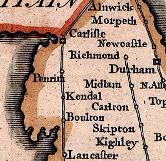
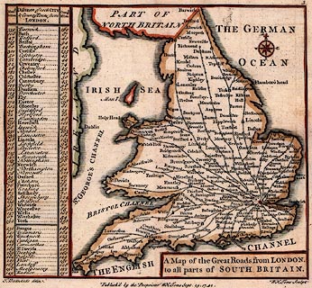
Map, hand coloured engraving, Great Roads from London to
all parts of South Britain, scale about 70 miles to 1 inch,
by Thomas Badeslade, engraved and published by William Henry
Toms, 1742.
The map is from the beginning of an atlas; it shows the principal roads from London; there i a table of distances of each city and county town from London, in computed and measured miles; South Britain is England and Wales, part of North Britain ie Scotland, is marked on the map. |
||

|
Badeslade 1742 | |
| map feature:- | plain cartouche & compass rose & coast shaded & roads & table of distances | |
| inscription:- |
printed title cartouche
A Map of the Great Roads from LONDON. / to all parts of SOUTH BRITAIN. |
|
| inscription:- |
printed bottom
T. Badeslade delin. / Published by the Proprietor W H Toms Sept. 29. 1742. / W H Toms Sculpt. |
|
| scale:- | 1 to 4500000 ? (estimated) | |
|
||
|
|
notes | |