 Badeslade 1742

|

|
|
|
item:- Hampshire Museums : FA1998.180 image:- © see bottom of page |
click to enlarge |
|
|
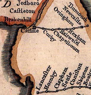
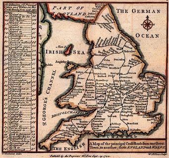
Map, hand coloured engraving, Cross Roads from One Great
Town to another through England and Wales, scale about 71
miles to 1 inch, by Thomas Badeslade, engraved and published
by William Henry Toms, 1742.
The map is from the beginning of an atlas; it shows the cross roads joining towns in England and Wales; the map looks a little strange out of its context, lacking the principal roads; there is a table of distances between towns in computed and measured miles. |
||

|
Badeslade 1742 | |
| map feature:- | plain cartouche & compass rose & coast shaded & roads & table of distances & settlements | |
| inscription:- |
printed title cartouche
A Map of the principal Cross Roads from one Great Town, to another; thro : ENGLAND and WALES. |
|
| inscription:- |
printed bottom
T. Badeslade delin. / Published by the Proprietor W H Toms Sept. 29. 1742. / W H Toms Sculpt. |
|
| scale:- | 1 to 4500000 ? (estimated) | |
|
||
|
|
notes | |