 Old Cumbria Gazetteer
 |
 |
|
| St Oswald's, Grasmere | ||
| St Oswald's | ||
| locality:- | Grasmere | |
| civil parish:- | Lakes (formerly Westmorland) | |
| county:- | Cumbria | |
| locality type:- | buildings | |
| locality type:- | locality | |
| coordinates:- | NY33190727 | |
| 1Km square:- | NY3307 | |
| 10Km square:- | NY30 | |
|
|
||
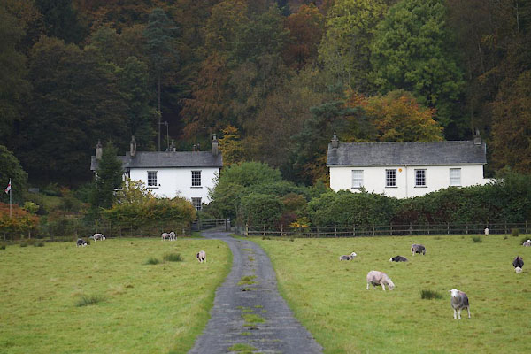 CBW28.jpg and The Wray on the left. (taken 17.10.2014) |
||
|
|
||
| evidence:- | old map:- OS County Series (Wmd 25 4) placename:- St Oswald's |
|
| source data:- | Maps, County Series maps of Great Britain, scales 6 and 25
inches to 1 mile, published by the Ordnance Survey, Southampton,
Hampshire, from about 1863 to 1948. |
|
|
|
||
| evidence:- | old text:- Martineau 1855 |
|
| source data:- | Guide book, A Complete Guide to the English Lakes, by Harriet
Martineau, published by John Garnett, Windermere, Westmorland,
and by Whittaker and Co, London, 1855; published 1855-76. goto source goto sourcePage 50:- "... and plunge down Red Bank, ... at the corner, where the road turns to the village, the cluster of lodging-houses, called St. Oswald's, where the Hydropathic Establishment struggled on for a time, but found the Westmorland winters too long for invalids." |
|
|
|
||
| evidence:- | database:- Listed Buildings 2010 placename:- St Oswalds |
|
| source data:- | courtesy of English Heritage "ST OSWALDS / / / LAKES / SOUTH LAKELAND / CUMBRIA / II / 451925 / NY3319207270" |
|
|
|
||
Lakes Guides menu.