 Old Cumbria Gazetteer
 |
 |
|
| Water Head, Coniston | ||
| Water Head | ||
| site name:- | Coniston Water | |
| civil parish:- | Coniston (formerly Lancashire) | |
| county:- | Cumbria | |
| locality type:- | locality (of land and of the lake) | |
| coordinates:- | SD31509792 (etc) | |
| 1Km square:- | SD3197 | |
| 10Km square:- | SD39 | |
|
|
||
| evidence:- | old map:- Crosthwaite 1783-94 (Con) |
|
| source data:- | Map, uncoloured engraving, An Accurate Map of Coniston Lake,
scale about 3 inches to 1 mile, by Peter Crosthwaite, Keswick,
Cumberland, 1788, version published 1809.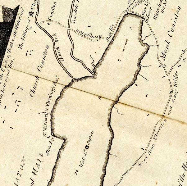 CTESD39D.jpg item:- JandMN : 182.5 Image © see bottom of page |
|
|
|
||
| evidence:- | old map:- Cooke 1802 placename:- Water Head |
|
| source data:- | Map, The Lakes, Westmorland and Cumberland, scale about 8.5
miles to 1 inch, engravedby Neele and Son, published by
Sherwood, Jones and Co, Paternoster Road, London, 1824. click to enlarge click to enlargeGRA1Lk.jpg "Water Head" locality item:- Hampshire Museums : FA2000.62.5 Image © see bottom of page |
|
|
|
||
| evidence:- | old print:- Wilkinson 1810 (plate 5) placename:- Coniston Water Head item:- packhorse |
|
| source data:- | Print, uncoloured soft ground etching, Coniston Water Head, Cumberland, by Joseph
Wilkinson, engraved by William Frederick Wells, published by R Ackermann, Repository
of Arts, 101 Strand, London, 1810.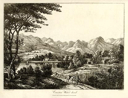 click to enlarge click to enlargeWKN105.jpg Plate 5 in Select Views in Cumberland, Westmoreland, and Lancashire. printed at bottom left, right, centre:- "Revd. Jos: Wilkenson delt. / W. F. Wells sc. / Coniston Water-head. / Published Sepr. 1. 1810. by R. Ackermann. 101. Strand. London." item:- Fell and Rock Climbing Club : MN4.5 Image © see bottom of page |
|
|
|
||
| evidence:- | old map:- Otley 1818 placename:- Waterhead |
|
| source data:- | Map, uncoloured engraving, The District of the Lakes,
Cumberland, Westmorland, and Lancashire, scale about 4 miles to
1 inch, by Jonathan Otley, 1818, engraved by J and G Menzies,
Edinburgh, Scotland, published by Jonathan Otley, Keswick,
Cumberland, et al, 1833.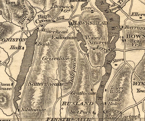 OT02SD39.jpg Notice the building at the road junction on the shore of the lake. item:- JandMN : 48.1 Image © see bottom of page |
|
|
|
||
| evidence:- | descriptive text:- Otley 1823 (5th edn 1834) placename:- Coniston Waterhead item:- geology; glacial erratic |
|
| source data:- | Guide book, A Concise Description of the English Lakes, the
mountains in their vicinity, and the roads by which they may be
visited, with remarks on the mineralogy and geology of the
district, by Jonathan Otley, published by the author, Keswick,
Cumberland now Cumbria, by J Richardson, London, and by Arthur
Foster, Kirkby Lonsdale, Cumbria, 1823; published 1823-49,
latterly as the Descriptive Guide to the English Lakes. goto source goto sourcePage 164:- "... a large block near Skelwith Bridge on the road to Grasmere - one near Coniston Waterhead, and another near Gosforth, as well as many others of smaller dimensions - are far more interesting to the geologist; yielding sufficient scope for conjecture as to the place of their origin, and the mode of their removal." |
|
|
|
||
| evidence:- | old map:- Ford 1839 map placename:- Waterhead |
|
| source data:- | Map, uncoloured engraving, Map of the Lake District of
Cumberland, Westmoreland and Lancashire, scale about 3.5 miles
to 1 inch, published by Charles Thurnam, Carlisle, and by R
Groombridge, 5 Paternoster Row, London, 3rd edn 1843.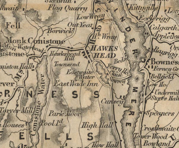 FD02SD39.jpg "Waterhead" item:- JandMN : 100.1 Image © see bottom of page |
|
|
|
||
Lakes Guides menu.