 Old Cumbria Gazetteer
 |
 |
|
| Fairy Kettle, Howk | ||
| Fairy Kettle | ||
| site name:- | Whelpo Beck | |
| locality:- | Howk | |
| civil parish:- | Caldbeck (formerly Cumberland) | |
| county:- | Cumbria | |
| locality type:- | churn pot | |
| coordinates:- | NY31863978 | |
| 1Km square:- | NY3139 | |
| 10Km square:- | NY33 | |
| SummaryText:- | The Fairy Kettle is a churn pot that is only wet when the river is high. | |
| references:- | OS County Series |
|
|
|
||
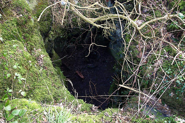 BOS83.jpg From above. (taken 1.3.2008) 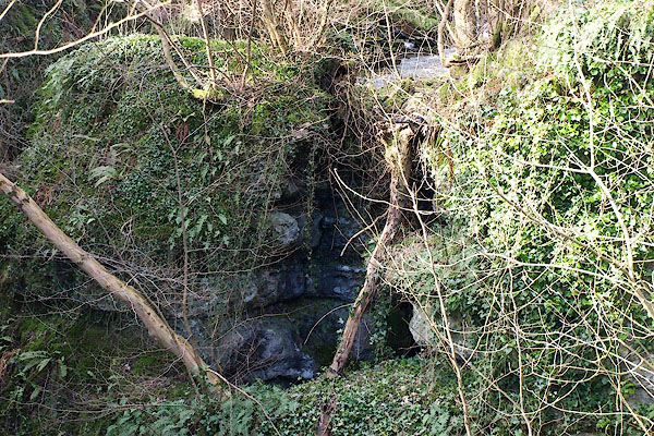 BOS84.jpg From below. (taken 1.3.2008) |
||
|
|
||
| evidence:- | old map:- OS County Series (Cmd 37 12) placename:- Fairy Kettle |
|
| source data:- | Maps, County Series maps of Great Britain, scales 6 and 25
inches to 1 mile, published by the Ordnance Survey, Southampton,
Hampshire, from about 1863 to 1948. |
|
|
|
||
| evidence:- | descriptive text:- Ford 1839 (3rd edn 1843) placename:- Fairy Kettle |
|
| source data:- | Guide book, A Description of Scenery in the Lake District, by
Rev William Ford, published by Charles Thurnam, Carlisle, by W
Edwards, 12 Ave Maria Lane, Charles Tilt, Fleet Street, William
Smith, 113 Fleet Street, London, by Currie and Bowman,
Newcastle, by Bancks and Co, Manchester, by Oliver and Boyd,
Edinburgh, and by Sinclair, Dumfries, 1839. goto source goto sourcePage 96:- "... On one side [of The Howk] is a deep excavation called the Fairy's Kettle, the receptacle in time of floods of another cascade that falls about twenty yards down perpendicular rocks: ..." |
|
|
|
||
Lakes Guides menu.