 Old Cumbria Gazetteer
 |
 |
|
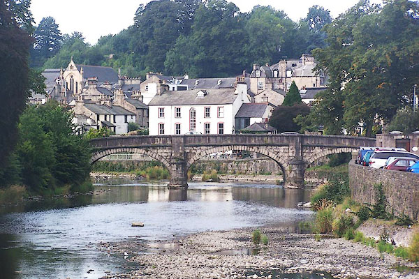
| Miller Bridge, Kendal | ||
| Miller Bridge | ||
| site name:- | Kent, River | |
| locality:- | Kendal | |
| civil parish:- | Kendal (formerly Westmorland) | |
| county:- | Cumbria | |
| locality type:- | bridge | |
| coordinates:- | SD51699265 | |
| 1Km square:- | SD5192 | |
| 10Km square:- | SD59 | |
|
|
||
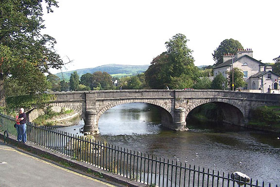 BMR89.jpg (taken 25.9.2006) 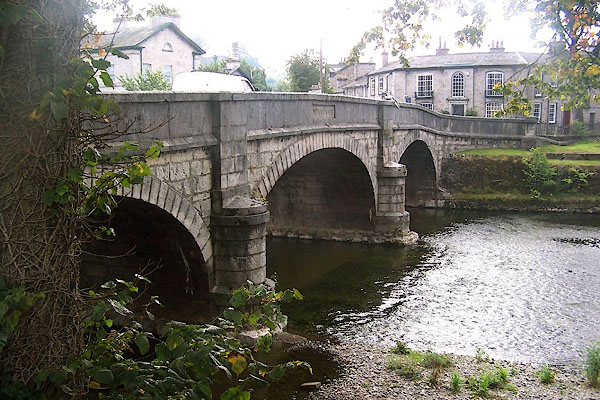 BMO38.jpg (taken 25.8.2006) |
||
|
|
||
| evidence:- | old map:- OS County Series (Wmd 38 8) placename:- Miller Bridge |
|
| source data:- | Maps, County Series maps of Great Britain, scales 6 and 25
inches to 1 mile, published by the Ordnance Survey, Southampton,
Hampshire, from about 1863 to 1948. |
|
|
|
||
| evidence:- | old map:- Ogilby 1675 (plate 38) |
|
| source data:- | Road strip map, hand coloured engraving, continuation of the
Road from London to Carlisle, scale about 1 inch to 1 mile, by
John Ogilby, London, 1675.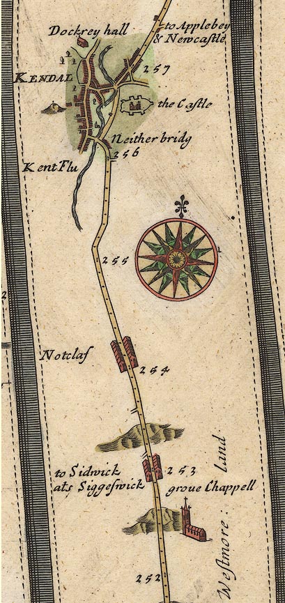 OG38m252.jpg In mile 256, Westmoreland. Street in Kendal crossing the River Kent. item:- JandMN : 21 Image © see bottom of page |
|
|
|
||
| evidence:- | descriptive text:- Simpson 1746 |
|
| source data:- | Atlas, three volumes of maps and descriptive text published as
'The Agreeable Historian, or the Compleat English Traveller
...', by Samuel Simpson, 1746. goto source goto sourcePage 1023:- "..." "Kendal, called also Kirkby Candale, i.e. a Church in the Valley upon the River Can, over which it has two Bridges of Stone, and one of Wood, ..." |
|
|
|
||
| evidence:- | old map:- Jefferys 1770 placename:- Mill Bridge |
|
| source data:- | Map, 4 sheets, The County of Westmoreland, scale 1 inch to 1
mile, surveyed 1768, and engraved and published by Thomas
Jefferys, London, 1770.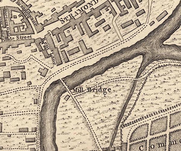 J55192T.jpg "Mill Bridge" bridge item:- National Library of Scotland : EME.s.47 Image © National Library of Scotland |
|
|
|
||
| evidence:- | probably old map:- Jefferys 1770 (Wmd) |
|
| source data:- | Map, 4 sheets, The County of Westmoreland, scale 1 inch to 1
mile, surveyed 1768, and engraved and published by Thomas
Jefferys, London, 1770. J5SD59SW.jpg double line, road, across a stream; bridge item:- National Library of Scotland : EME.s.47 Image © National Library of Scotland |
|
|
|
||
| evidence:- | old map:- Otley 1818 |
|
| source data:- | Map, uncoloured engraving, The District of the Lakes,
Cumberland, Westmorland, and Lancashire, scale about 4 miles to
1 inch, by Jonathan Otley, 1818, engraved by J and G Menzies,
Edinburgh, Scotland, published by Jonathan Otley, Keswick,
Cumberland, et al, 1833.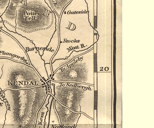 OT02SD59.jpg Implied by a road across the Kent. item:- JandMN : 48.1 Image © see bottom of page |
|
|
|
||
 BMO37.jpg (taken 25.8.2006) 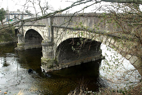 BYC72.jpg (taken 11.4.2013) |
||
|
|
||
| hearsay:- |
This was originally a wooden bridge, regularly washed away by floods. It was built
of stone in 1743. The present bridge was designed by Francis Webster. |
|
|
|
||
Lakes Guides menu.