 Old Cumbria Gazetteer
 |
 |
|
| Turn House, Grasmere | ||
| Turn House | ||
| locality:- | Grasmere | |
| civil parish:- | Lakes (formerly Westmorland) | |
| county:- | Cumbria | |
| locality type:- | buildings | |
| coordinates:- | NY32990982 | |
| 1Km square:- | NY3209 | |
| 10Km square:- | NY30 | |
|
|
||
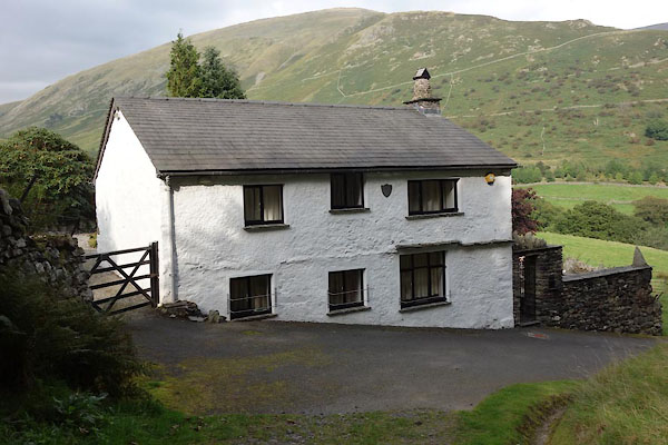 CBQ08.jpg (taken 8.9.2014) |
||
|
|
||
| evidence:- | probably old map:- Jefferys 1770 (Wmd) placename:- Tarn Bank |
|
| source data:- | Map, 4 sheets, The County of Westmoreland, scale 1 inch to 1
mile, surveyed 1768, and engraved and published by Thomas
Jefferys, London, 1770.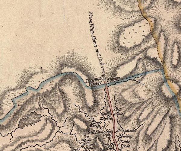 J5NY31SW.jpg "Tarn Bank" circle, labelled in italic lowercase text; settlement, farm, house, or hamlet? item:- National Library of Scotland : EME.s.47 Image © National Library of Scotland |
|
|
|
||
| evidence:- | old map:- Clarke 1787 map (Ambleside to Keswick) placename:- Turn How |
|
| source data:- | Map, A Map of the Roads Lakes etc between Keswick and Ambleside,
scale about 2.5 ins to 1 mile, by James Clarke, engraved by S J
Neele, 352 Strand, published by James Clarke, Penrith,
Cumberland and in London etc, 1787.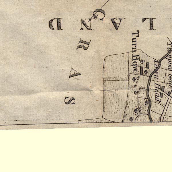 CL9NY20Z.jpg "Turn How" item:- private collection : 10.9 Image © see bottom of page |
|
|
|
||
| evidence:- | probably old map:- Cary 1789 (edn 1805) placename:- Torn Bank |
|
| source data:- | Map, uncoloured engraving, Westmoreland, scale about 2.5 miles
to 1 inch, by John Cary, London, 1789; edition 1805.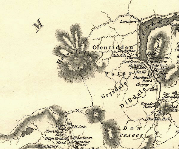 CY24NY31.jpg "Torn Bank" block/s, labelled in italic lowercase; house, or hamlet item:- JandMN : 129 Image © see bottom of page |
|
|
|
||
 Lakes Guides menu.